exmouth to seaton

south west coast path

3rd october 2013


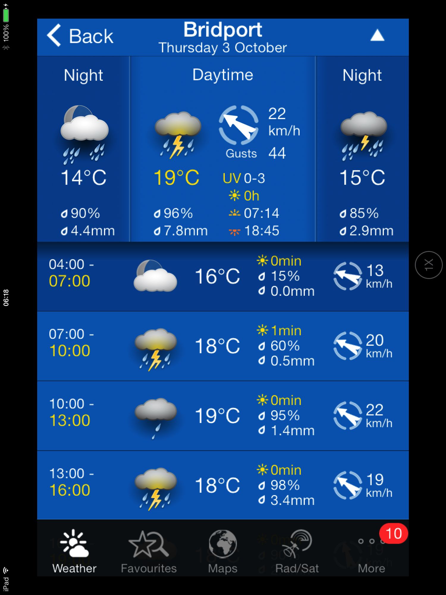
Today's weather forecast looks to be on the ropey side.

Turns out it was worse than forecast. It started raining heavily just before I reached Budleigh Salterton, I walked through a thunderstorm while going through Budleigh Salterton. After that the weather turned much worse and I walked through another big storm while going through Sidmouth and beyond. 

The rain finally relented just before I reached Branscombe and then it turned into rather a nice afternoon. By then I was soaked though! 

weather forecast.jpg

Today's walk starts at Exmouth and since there's a nice, sandy beach here I might as well stroll along it for a bit. I couldn't find any signs so lucked upon the coast path by going through Foxholes Car Park just before Orcombe Red Rocks.


exmouth

orcombe red rocks

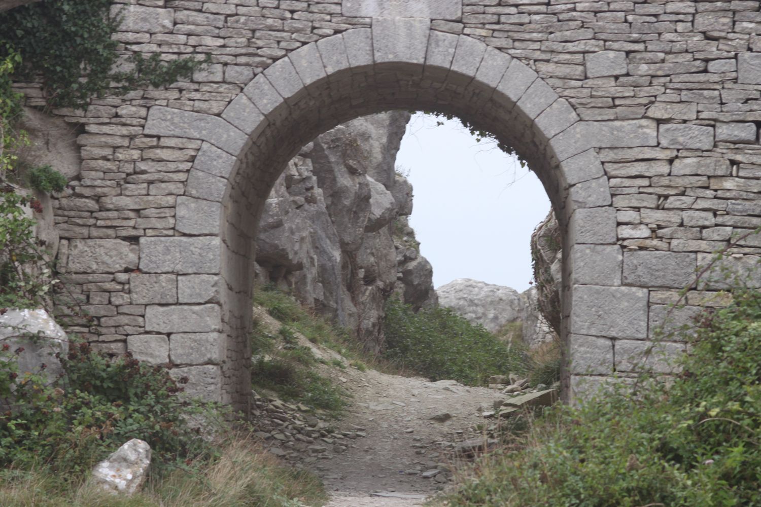
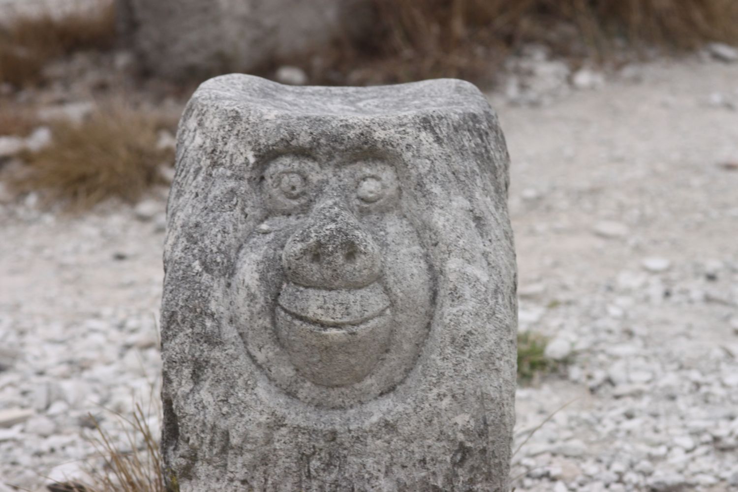
A path rises out of Exmouth to reach High Land of Orcombe and the start of the Jurassic Coast, a World Heritage Site stretching 95 miles from here right the way around to Dorset. A sign gives details of the Jurassic Coast and a Geoneedle can also be found which was unveiled by His Royal Highness the Prince of Wales, in 2002. The Geoneedle is constructed from a variety of different stones, representing both the major building stones to be found on the Jurassic Coast and the sequence of rocks that form this part of the coastline.

jurassic coast sign

geoneedle

geoneedle

I stay up on the cliffs passing the Devon Cliffs Holiday Park and the Beachcomber Bar before dropping down onto the beach just before Straight Point. The Royal Marine Ranges is found on Straight Point and they were practising today so a lot of gunfire was disturbing the tranquility. I climb back onto the cliffs, passing the rifle range, to reach Littleham Cove where there should be some fine views of the lovely crumbling red sandstone cliffs but it was a bit misty and the sea was red with sand.

beach and rifle range

littleham cove

I keep well away from the edge of the crumbling cliffs and climb onto Beacon Hill. A trig point is found showing the height to be 423 feet.

The path continues through some woodland and it is around here that it started chucking it down so I had to don my waterproofs. A tarmac path leads in to Budleigh Salterton and its pebbly beach. It was still chucking it down so I saw very little of Budleigh Salterton except for a shelter which I stayed in for a few minutes as a thunderstorm passed by.

budleigh salterton

budleigh salterton

I head along the sea front in the pouring rain but can't see very much.

The River Otter and the Otter Estuary Nature Reserve are reached so I turn inland in order to cross the River Otter via a road and then head back to the coast over the other side of the river. I don't see any otters but there are plenty of noisy geese here. There should be some fine views back to Budleigh Salterton but it's still chucking it down and still a bit misty.

view back to budleigh salter ton

More red sandstone cliffs are climbed and the going from here to past Sidmouth is going to get pretty rough. Another holiday park is encountered at Ladram Bay and a series of red sandstone stacks can be seen offshore.

ladram bay

There are lots of grassy slopes here including at Peak Hill but the path eventually reaches a road which drops in to Sidmouth

As I make my way through Sidmouth it is blowing a gale as well as tipping down with rain so I duck inland a bit to try and get some shelter. It's not the weather for photographs!

After enjoying the delights of a wet and windy Sidmouth I cross a bridge over the River Sid before climbing back onto the cliffs via a tarmac path. It's quite a climb up here (525 feet) but there are some benches at the top to rest and admire the view. Well, I admired it last time I was here in 2005 but there's not much to be seen today. 

view back to sidmouth

The path continues past South Combe Farm and down some steps to Salcombe Mouth where there is a pebbly beach. The coast path however, heads inland before climbing up on to the cliffs again at Higher Dunscombe Cliff. Even on this filthy day the views are spectacular. Here can be found the Weston Plats where, in the 19th century, thanks to the unique micro-climate on these cliffs, local residents were able to produce early crops of flowers, vegetables and strawberries.

view from the cliffs

weston mouth

After a walk along the clifftops the path descends on some steps to the beach at Weston Mouth. The path climbs steeply yet again to the top of Weston Cliff and then passes Weston Wild Flower Meadow. Unfortunately it's the wrong time of year now to enjoy the butterflies but if I came at the right time I could see Brimstones, Orange Tips, Skippers, Common Blues, Marbled Whites, Meadow Browns, Painted Ladies, Clouded Yellows and Red Spotted Burnets.

The path ducks inland at Coxe's Cliff before heading over grassy clifftops and descends once again, this time to Branscombe Mouth. The 62,000 tonne container ship MSC Napoli was beached here in January 2007 after experiencing difficulties during a storm.  After containers started to get washed up on the beach, scavengers started arriving to 'recycle' the contents. Unfortunately there are no longer any spare motorbikes lying around! The anchor of the ship, weighing 14 tonnes, was presented to the people of Branscombe by the ship's owners and was installed here in July 2008.

msc napoli anchor

branscombe beach

The weather has now vastly improved so I'm able to enjoy the beach here before another climb takes me to the top of East Cliff and I enter another caravan park, the Sea Shanty Caravan Park and then the coast path heads through the Hooken Undercliff, formed in 1790 by a slump in the chalk cliffs. I'm thankful for the undercliff as it saves me a hefty hike to the top of the cliffs.

hooken undercliffs

hooken undercliffs

I zig zag back up to the top of the cliff and round Beer Head before reaching the village of Beer. The Anchor Inn is on the seafront at Beer, just by the slipway, but seems to be lacking any signage whatsoever today. I continue to reach the Jubilee Memorial Grounds before joining a road.

beer

beer

Following exceptionally wet weather in 2012, there was a cliff fall severing part of Old Beer Road along  which the South West Coast Path used to run. As a result Old Beer Road is closed for walkers. It looks like a new route is being completed as I'm diverted through some woods to reach the other side of Old Beer Road. From here I trudge wearily into the destination for today, Seaton. It's been a long day!


FLORA AND FAUNA

Flora and fauna encountered on the walk today includes :-

  • noisy geese
  • little egrets
  • kestrels
  • no otters

Podcast

The podcast of today's walk is now available.  You can subscribe via the iTunes store or listen using the player below.

podcast logo small.png

MARKS OUT OF TEN?

According to my phone I've walked a whopping 24 miles today which amounts to 51851 steps. Despite the atrocious weather for most of the day it has been a great day's walking with plenty of interest to see (or not) throughout the day. 9 out of 10.


9 out of 10.png

View exmouth to seaton in a larger map

exmouth

swanage to south haven point

south west coast path

1st october 2013


The weather forecast for today looks to be a bit on the gloomy side again. This turns out to be true but with the wind blowing, doesn't feel as warm as promised.

weather forecast.jpg

Today's walk, at 7.5 miles (according to Paddy Dillon's South West Coast Path book), is the shortest walk on the South West Coast Path and, unless I dawdle, shouldn't take me longer than 2-3 hours. I start off by walking along the High Street and then the promenade to leave Swanage passing the Ship Inn, the White Swan and the Red Lion pubs.

swanage

beach huts

I walk along the beach until I reach a beach cafe below The Grand Hotel where I climb some stairs to reach the cliff top. I'm then forced to follow a series of roads to reach Ballard private estate. From here I reach another sandy beach before climbing up to the clifftop and head across Ballard Down to reach Ballard Point.

a misty ballard down

old harry rocks

Below can be seen loads of pinnacles and stacks including Old Harry Rocks. These are all that remain of what was once a large stretch of chalk between Purbeck and the Isle of Wight.

I head on around Handfast Point and onwards towards Studland, dropping down on to South Beach. Somewhere just offshore can be found seahorses. Despite this, Studland Bay was dropped as one of the potential Marine Conservation Zones recently.

south beach

The route out of South Beach seems to be closed because of a landslip so I head inland to Studland, passing the Bankes Arms Country Inn and the Isle of Purbeck Brewery (more use of Flash on their website I'm afraid) from which emanates a lovely smell of beer. I pass the Manor House Hotel, which is currently closed for refurbishment, to reach Middle Beach.

bankes arms country inn

isle of purbeck brewery

From here it's a two mile stroll along the beach to reach South Haven Point.

WARNING - part of the beach is given over as a naturist beach. It was blowing a gale and felt pretty cold so there weren't many hardy souls out today!

naturists warning

middle beach

And that's it really! I remove my boots and socks and paddle my way along the beach to reach the end of the South West Coast Path at South Haven Point. Well, in my dreams! I suspect the water was pretty cold today. At South Haven Point I take time to photograph the sculpture marking the end of the path.

south haven point


FLORA AND FAUNA

Flora and fauna encountered on the walk today includes :-

  • lots of sea weed
  • sea horses
  • razor clams
  • swallows
  • cormorants
  • seagulls
  • sweet chestnuts
  • oaks


Podcast

The podcast of today's walk is now available.  You can subscribe via the iTunes store or listen using the player below.

podcast logo small.png


MARKS OUT OF TEN?

According to my phone I've walked 9.5 miles today which amounts to 20459 steps. The weather has been excellent for walking if a little on the dull side when it comes to views. 7 out of 10.

7 out of 10.png

View swanage to south haven point in a larger map

swanage

isle of portland

south west coast path

30th september 2013


The weather forecast for the day looks to be on the damp and dreary side.

The sun did try to burn off the mistiness throughout the day but only managed to break through once before getting covered up by mist again. 

On the plus side it didn't rain and it was perfect walking weather but it wasn't great for photography. 

weather forecast.jpg

The walk begins at the Chesil Beach Visitors Centre located at the Ferrybridge car park. The road onto the Isle of Portland is extremely busy so I quickly cross the road and drop down onto the trackbed beside the road which used to be a railway line.

I reach what used to be Mere Tank Farm, an old oil storage depot, but this has now been demolished as part of the Olympic developments around here. What an eyesore it used to be but I rather liked the depot welcoming me on to Portland and I can't see anything of merit that has replaced it. 

I head in to Fortuneswell to Victoria Square, passing the Little Ship pub and the Royal Victoria Lodge (another eyesore!) which seems to be for sale. I check my pockets for loose change but don't have quite enough to make an investment. Instead I head for the Cove House Inn where the coast path goes along the sea wall before climbing steeply at West Weare. There are fantastic views back behind me over Chesil Beach. At least there should have been but it was a bit on the murky side.

royal victoria lodge

little ship

cove house inn

chesil beach

 'The Spirit of Portland' sculpture, showing a fisherman and a quarryman, is found a little way down the pavement in the opposite direction of the coast path. 

spirit of portland

I usually head through Tout Quarry instead of following the official coast path so I do this once again. The limestone from this quarry was used for St Paul's Cathedral and Buckingham Palace. Not to be outdone I pocket a few bits of limestone for myself. The quarry is now disused and contains a sculture park which is well worth visiting and is also a nature reserve. I spend a bit of time photographing some of the sculptures.

I regain the official coast path after exiting the quarry and head along the cliffs towards Portland Bill. The coast path should run along the cliff tops at West Cliff but subsidence has closed the path here and there is a diversion inland. The diversion didn't last for long and was soon back on the clifftops. The path passes between a disused lighthouse and the National Coastwatch Station and heads down the grassy slopes towards the red and white lighthouse at Portland Bill where the Lighthouse Visitor Centre can be found. A few clumps of feathers lie amongst the grass as if someone has recently made a killing here.

red and white lighthouse

pulpit rock

 Pulpit Rock stands offshore so I spend a bit of time exploring the rocky shore as well as recording some video and audio and munching on a sandwich.

The place is deserted and I've never seen it so quiet. 

The path continues past loads of beach huts. One of these huts could cost you around £25000! A fat and rather guilty sparrowhawk is perched on one of the beach huts!

The path then changes direction to head roughly north up the eastern side of the Isle of Portland. It heads along quarried cliffs where a couple of hand cranes can be found as well as Cave Hole, a large cave with a blow hole where I recorded some more video.

beach huts

coombefield quarry

After navigating more quarry works the coast path continues along a grassy verge beside the road and reaches Coombefield quarry which is still in use.

The path reaches a viewpoint at Cheyne Weare. A sign here claims that I can see the chalk coastline along Weymouth Bay, the Purbecks, St Albans Head near Swanage and Lulworth Cove. Dream on!! All I can see is mist. 

mist at cheyne weare

The path continues down to Church Ope Cove. I pause to admire the beach huts here before climbing back up some steps to reach a viewpoint. 

church ope cove

The path continues past Broadcroft quarry and reaches Portland Young Offenders Institution and then Verne Citadel, now used as a category C men's prison.

wallabies

I pass a sign pointing to King Barrow Quarries before encountering some wallabies!!

A tunnel leads to Verne High Angle Battery, a derelict fort built in 1892. From here the coast path seems to take a new route - either that or I've never found it before - and looks over a misty Castletown before descending to what seems to now be called Osprey Quay. Needless to say, I didn't encounter any Ospreys!


castletown

I head back along the track next to the noisy A354 to reach the end of the walk back at the car park at Ferrybridge.

FLORA AND FAUNA

Flora and fauna encountered on the walk today includes :-

  • lots of swallows
  • lots of snails
  • fox moth caterpillars
  • sparrowhawk
  • great tit
  • rose hips

fox moth caterpillar

Podcast

The podcast of today's walk is now available.  You can subscribe via the iTunes store or listen using the player below.

podcast logo small.png

MARKS OUT OF TEN?

According to my phone I've walked 13.5 miles today which amounts to 29068 steps. The weather has been excellent for walking if a little on the dull side when it comes to views. 7 out of 10.


7 out of 10.png

View isle of portland in a larger map

lighthouse

abbotsbury to ferrybridge

south west coast path

29th september 2013

The weather forecast for today looked a bit dull and damp when I looked at my weather app first thing this morning.

weather forecast.jpg

As it turned out, it was a thoroughly pleasant and sunny day. I thought I hadn't taken a screenshot of the weather forecast this morning (it turned out I had) and maybe I was making the gloomy forecast up so I checked the weather forecast again while I was out walking and it had changed completely. Not very often my weather app gets it completely wrong.

weather forecast 2.jpg

Today's walk is perhaps not the most exciting walk, largely being inland due to the presence of Chesil Beach, but it's great to be back walking on the Dorset coast. Apparently Chesil Beach consists of 180 billion pebbles but I've not got time to count them all as I've got some serious walking to do.

chesil beach pebbles

chesil beach

The walk starts at the car park behind Chesil Beach just before Abbotsbury. I head down to the beach to admire it's majesty before heading back to the coast path. The path detours inland towards Chapel Hill where St Catherine's Chapel can be seen.

The coast path passes Abbotsbury Swannery before taking to grassy hills with some lovely views back over Chesil Beach.


Abbotsbury

Abbotsbury is a village and civil parish in the English county of Dorset. It lies in the West Dorset administrative district, and is known for its swannery, subtropical gardens and historic stone buildings.


The path passes above Clayhanger Farm and through loads of fields with the coast at some distance. I detour inland again, this time to visit Langton Herring and the parish church of St Peter as well as the Elm Tree Inn. The reviews for the inn don't look too hot so it's a good job it's too early for opening time.

parish church of st peter

elm tree inn

I head back to the coast path to reach West Fleet with a view over to Herbury Island.

I finish listening to an episode of Ramblings here, featuring Werca's Folk Women's Choir. Well worth a listen if you like folk choirs or grew up watching Bagpuss.


herbury island

boats on the fleet

The path continues past Gore Cove and the Moonfleet Manor Hotel and Restaurant, named after J.M. Falkner’s novel Moonfleet in which he describes a lake of brackish water full of “sea-fowl, herons, and oysters ... shut off from the open Channel by a monstrous great beach or dike of pebbles”.

sea-fowl, herons, and oysters ... shut off from the open Channel by a monstrous great beach or dike of pebbles
— moonfleet

 East Fleet Touring Park can be found here and some gallops are close by but I didn't see any horses today.

 I continue along the shore to reach East Fleet where I visit the remains of Old Church. Only the chancel remains and the rest of the church was destroyed in a storm in 1824 which breached Chesil Beach.

old fleet church

chickerell rifle range

Chickerell Rifle Range is reached but the red flags weren't flying today so I was able to cross the range without any problems.

east fleet lagoon

I carry on to reach Lynch Cove and then accidentally walk into a swamp and end up covered in stinky mud before having to head inland again to bypass the Wyke Regis Army Training Area.

wyke regis army training area

I continue back to the coast before finally reaching a beach at Pirate's Cove. The path passes in front of a caravan site and then Crab House Cafe. It occupies a ragged boatyard of a site overlooking the eastern end of the Fleet lagoon, just before the bridge to the Isle of Portland.

I pass the Ferrybridge Inn at Ferrybridge before heading on to the end of the walk at the Ferrybridge car park next to Chesil Beach Visitors Centre.

chesil beach visitors centre


Ferrybridge

Ferrybridge is on the causeway to the Isle of Portland, Dorset and is the point at which the Fleet lagoon joins Portland Harbour.


FLORA AND FAUNA

Flora and fauna encountered on the walk today includes :-

  • lots of swallows
  • lots of pheasants
  • sheep
  • geese
  • roses at Langton Herring


Podcast

The podcast of today's walk is now available.  You can subscribe via the iTunes store or listen using the player below.

podcast logo small.png

Marks out of ten?

My pedometer app failed to start today so I don't have any step figures today but the walk is about 12 miles. Relatively easy walking and lovely weather. 6 out of 10.


6 out of 10.png

View abbotsbury to ferrybridge in a larger map

chesil beach

lanivet to fowey

the saints' way

11th september 2013

The weather forecast for the day looks a bit on the dull side but at least it will be cooler than the last few days. 

weather forecast.jpg

Today's walk features loads of wayside crosses along the way. The churchyard of the parish church of St Nivet at Lanivet contains two finely carved crosses. The first, a wheel headed cross can be found to the north of the church and the second, a four holed cross, can be found to the west of the church.  

lanivet parish church

wheel headed cross

four holed cross

reperry cross

granite guide stone

The Way climbs out of Lanivet village and goes under the A30 to Reperry Cross. A wheel headed cross can be found here on top of a hedge. A granite guide stone is encountered, pointing the way back to Lanivet.  Thomas Hardy visited here in 1872 and wrote the poem 'Near Lanivet'.

There was a stunted handpost just on the crest,
Only a few feet high:
She was tired, and we stopped in the twilight-time for her rest,
At the crossways close thereby.

st ingunger

A bit further on another wayside cross is encountered close to St Ingunger farm. The path continues through Fenton Pits where another cross can be found at the side of the road. 

fenton pits

The path reaches the hamlet of Trebell Green and continues to Helman Tor Gate. At this point the Way splits into two, one way travelling to Fowey via Luxulyan and Tywardreath. My route today reaches Fowey via Lanlivery and Golant.


I take a detour to climb the summit of Helman Tor Gate at 680 feet to visit the remains of a 6000 year old Neolithic enclosure. The view today is fantastic, if a bit on the dull side, and I can look back to the Atlantic coast and the start of the Way, and forwards to the English Channel and the end of the walk. 

helman tor gate

view from helman tor gate

menawink cross

The path continues towards Lanlivery along an ancient granite hedged ridgeway before joining a minor road. Menawink Cross can be found here.

The path continues over Pennant Crossroads to reach the village of Lanlivery. The path passes the Lanlivery Parish Church, St Brevita  and the Crown Inn where I'd have been tempted by a pint of Doombar but it was nowhere near opening time. 

lanlivery parish church

The Way leaves the village and briefly follows the A390 to Lostwithiel where a wayside cross known as Crewel can be found at No Man's Land. 

crewel cross

The path turns right at some granite gateposts. A filthy bridleway was shut here so I had to divert close to Lostwithiel before reaching Castle and Milltown and continued under the railway bridge of the Paddington to Penzance line, passing Lantyan and Woodgate Woods where the Fowey River can now be glimpsed. 

Our home from home for the week, Golant, is reached where St Sampson's Church can be found as well as the tempting Fisherman's Arms. A pint of Doombar here can wait until the walk is finished.

st sampson's church

The path leaves the village by a footpath up onto the downs with lovely views over the estuary and continues through woods down to Sawmills Creek. 

sawmills recording studio

The 17th century water mill found here now houses Sawmills recording studio  where the likes of XTC, Robert Plant, The Stone Roses, Oasis, The Verve, Supergrass and Muse have all recorded. 

The path continues across a stream and ascends to Penventinue Farm before reaching the main road in to Fowey. It passes the Bodinnick Ferry at Caffa Mill before finally reaching Fowey.

The last stretch climbs Bull Hill to reach the end of the Saints' Way at the Church of St Fimbarrus which means it's Doombar time so after pottering around for a bit in Fowey I head back to the Fishermans Arms in Golant.

st fimbarrus

A guide pack of The Saints' Way can be obtained from the Fowey tourism website for £4.99 plus £2 postage at the time of writing. The pack features 13 full colour, laminated and illustrated cards: eight route cards, each showing a map section of the journey including information on distance, time, terrain, and facilities, as well as descriptions and information about places on the route.

flora and fauna

Flora and fauna encountered on the walk today includes :-

  • dead badgers
  • dead squirrel
  • dead shrew
  • cows
  • swallows
  • robin
  • grey wagtail
  • ferns
  • lichens
  • llamas


Podcast

The podcast of today's walk is now available.  You can subscribe via the iTunes store or listen using the player below.

podcast logo small.png

Marks out of ten?

According to my phone I've walked 16 miles today which amounts to 34420 steps. The way marking has been excellent again so for a change I haven't got lost once and I've only been stung by nettles once so that also makes a pleasant change. 8 out of 10.

Why do so many websites in these parts use evil Flash though? 

8 out of 10.png

View lanivet to fowey in a larger map

helman tor Gate