padstow to lanivet

the saints' way

10th september 2013

This is the first leg of a two day walk along The Saints' Way, a walk across Cornwall from Padstow to Fowey. The first day's walk is from Padstow to Lanivet and it's an unusual walk for me as it leaves the coast behind almost immediately.

padstow

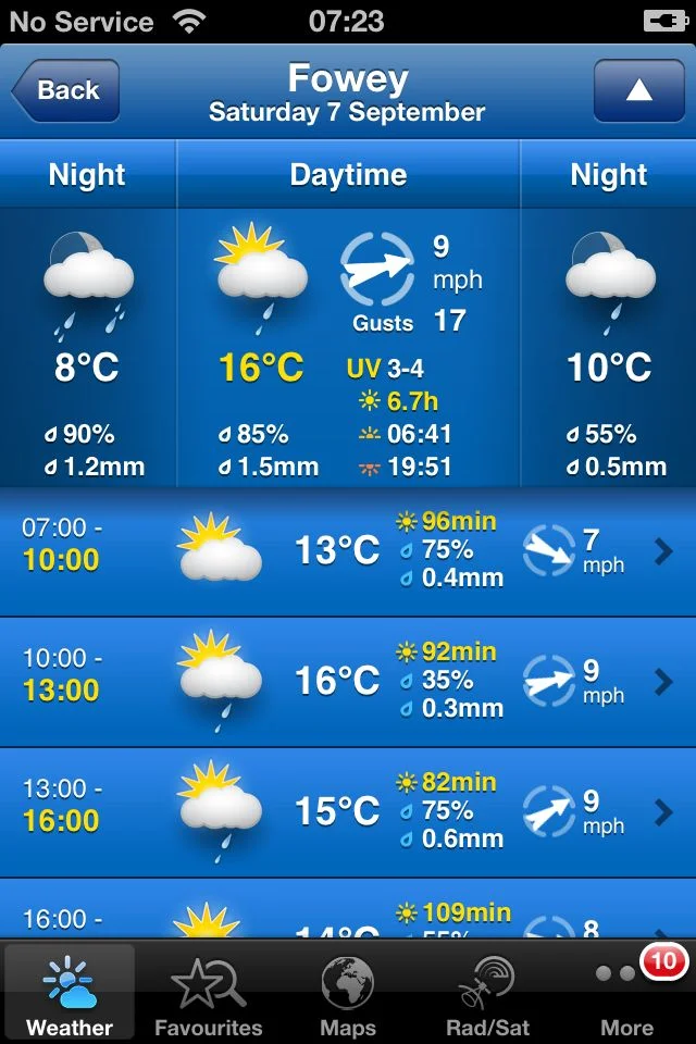
The weather forecast for the day looks fantastic so I might be in for another hot and sticky day. Fortunately the distance covered won't be as much as the previous three days. 

weather forecast.jpg

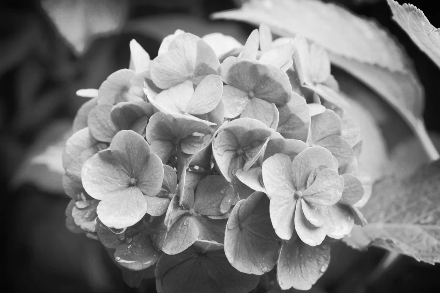
Today's walk begins at the lych gate of St Petroc Church, a little inland from Padstow's harbour.  A Celtic four holed cross by the door of the church hints at the original Celtic monastery that would have once inhabited the churchyard.


celtic four holed cross

st petroc church

camel estuary

The footpath leaves Padstow (good luck finding any signs) via Hill Street, Dennis Road and Dennis Lane with the Camel estuary on the left and climbs Dennis Hill with a granite obelisk on the top.  There are some lovely views across the Camel estuary here.


The path continues to Trerethern Creek where a tidal mill, 'Seamills', used to work by impounding the waters at high tide and then releasing them as the tide receded.

A 14th century church is reached at Little Petherick. The church was rebuilt in the mid 1800s and the interior was restored in 1898.

little petherick

little petherick interior

The Saints' Way follows the A389 for a bit before reaching Mellingey, a hamlet containing a handful of cottages and a five storey mill, before reaching the hamlet of Trenance.


mellingey

The Way crosses the A39 and passes West Park Farm and No Man's Land before climbing to St Breock Downs. The Bronze Age St Breock Longstone - the heaviest standing stone in Cornwall, weighing 16.5 tonnes - is found together with a number of burial barrows. There are spectacular views back to the Camel estuary to the north and the china clay tips to the south.  The prehistoric hill fort of Castle-an-Dinas can be seen to the west. 

st breock longstone

view from st breock downs

It's windy up here!!

ford

The Way then drops down to Hustyn Wood passing a number of wind turbines. The Way passes through Tregawne Valley to reach Tregustick and then a ford at the Ruthern River. 


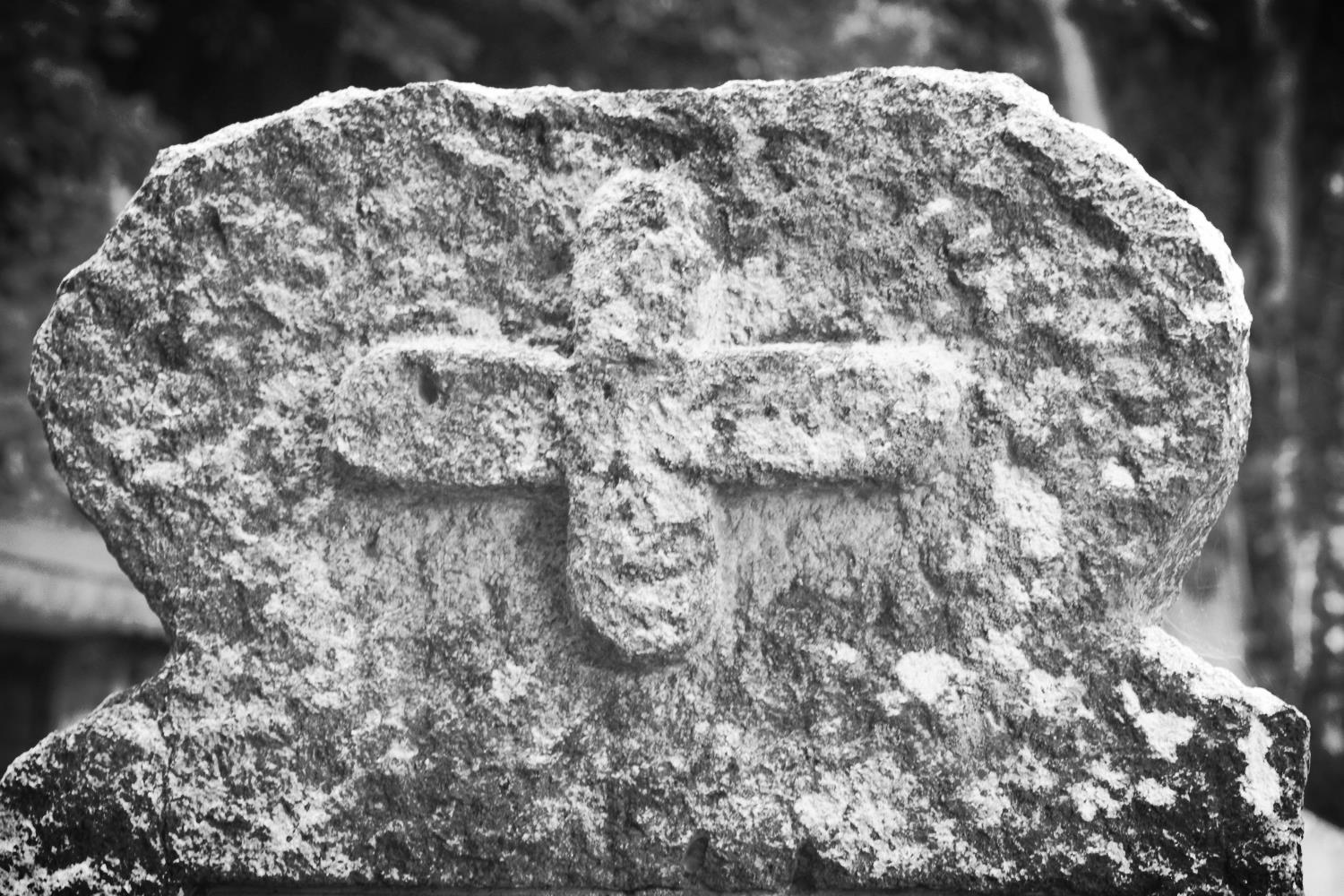
The path continues to the village of Withiel with its medieval church of St Clement before reaching the hamlet of Retire and passes Tremore Manor gatehouse. A Celtic cross can be found in the road verge here. I struggled to find it so it might be hidden amongst stinging nettles at the moment.

st clement's church

guidepost

Just before reaching the granite clapper bridge spanning the River Ruthern at Tremorebridge, a 19th century cast iron guidepost can be found.

The Saints' Way then heads towards the destination for the day and the half way point, Lanivet village and the day should have ended with a refreshing pint of Tribute in the Lanivet Inn but it was closed so I headed back to the Fisherman's Arms instead.

lanivet inn

A guide pack of The Saints' Way can be obtained from the Fowey tourism website for £4.99 plus £2 postage at the time of writing. The pack features 13 full colour, laminated and illustrated cards: eight route cards, each showing a map section of the journey including information on distance, time, terrain, and facilities, as well as descriptions and information about places on the route.

flora and fauna

Flora and fauna encountered on the walk today includes :-

  • little egrets
  • cows
  • swallows
  • pheasants
  • pigeons
  • blackberries
  • swans
  • japanese anemones

Podcast

The podcast of today's walk is now available.  You can subscribe via the iTunes store or listen using the player below.


podcast logo small.png

Marks out of ten?

According to my phone I've walked 17.3 miles today which amounts to 37119 steps. What a thoroughly charming walk this had been today especially considering that the coast was left behind so early on in the day. 8 out of 10. After leaving Padstow the way marking has been fantastic and I'd have never have found my way without them. Can whoever is responsible move on to do the South West Coast Path now! Thank you. 


8 out of 10.png

View padstow to lanivet in a larger map

padstow harbour

looe to plymouth

south west coast path

9th september 2013

The weather forecast for the day looks to be pretty good again. As it turns out it was a hot, sticky and long day's walking. No waterproofs required here! 

weather forecast.jpg

I started the day by walking down the harbourside at East Looe, passing the Ship Inn and took one last look at the harbour before heading back to the coast path. 

looe

east looe beach

East Looe Beach, a crescent shaped, sandy beach is found - you guessed it! - on the east side of Looe and, as it was relatively early still, was fairly quiet.

The path climbs steeply out of Looe before descending down to Millendreath Beach, a sandy beach with numerous rock pools to explore at low tide. The tide was in so I had a sandwich for breakfast, sharing the beach with the local dog walkers.

millendreath beach

Due to a series of landslips the coast path was closed over Bodigga Cliff so I had to take the road inland, passing the Monkey Sanctuary and rejoined the coast path as it led down to Seaton. The beach at Seaton is a spacious grey sand beach popular with families and you can find the Seaton Beach Cafe here.

diversion between millendreath and seaton

seaton

downderry beach

The tide was out (or so I thought) so I headed along the sea wall to reach Downderry Beach. The tide was further in than I expected so I had to clamber down the sea defences to get to the beach, a sheltered beach made of grey sand and shingle with rock pools at low tide. The wreck of ‘Gypsy’, the sister ship to the ‘Cutty Sark,’ is hidden under a kelp bed not far from the shore line. I passed underneath the Inn on the Shore at the far end of Downderry Beach.

After leaving Downderry the path passes St Nicholas' Church and Downderry Lodge and climbs up to Battern Cliffs. The path descends to another beach with the Long Stone stack prominent just offshore.

the view from battern cliffs

Eventually the path reaches the village of Portwrinkle passing the tiny harbour. There are two sand and shingle beaches here with numerous rock pools.

Slightly inland can be found the Finnygook Inn and the Liscawn Inn but the day is still young and I've still got a lot of walking to do..


Portwrinkle

Portwrinkle is a small coastal village situated at the western end of Whitsand Bay. Portwrinkle was traditionally a fishing village and the old 17th century walls of the pilchard cellars are still standing although they have been incorporated into housing. The Gook Beach Cafe can be found on the cliff above Portwrinkle beach.


The road leaves Portwrinkle and goes past the Whitsand Bay Hotel, wending its way around Tregantle Fort. I thought it was supposed to be firing day today but the gate heading into Tregantle Fort wasn't locked so I risked life and limb to enter the fort. A pleasant surprise just below the fort were a load of autumn ladies tresses.

autumn ladies tresses

The path continued to Sharrow Point and then up towards the holiday cabins at Freathy and Whitsand Bay Holiday Park. The path usually takes a circuitous route through the cabins clinging to the cliff but a diversion was in place along the road at the top of the cliff.

Whitsand Bay beach, a series of beaches stretching to around four miles, can be found here but access to the beach is difficult via steep steps and paths.  The views here are fantastic.

whitsand bay

The path then circles around Rame Head with a view to St Michael's Chapel on the headland. Also visible is the National Coastwatch Rame Head Station

st michael's chapel

The path descends to Penlee Point before reaching the village of Cawsand. The tide was out so I was able to enjoy the sand and shingle beach. On leaving the beach I passed the Cross Keys Inn on The Square at Cawsand. As enticing as the pub was, Plymouth awaits! Onwards the path leads to the adjoining village of Kingsand, passing the Halfway House Inn, which has another small sand and shingle beach. Between the two villages a house is passed, called Devon Corn, which has a marker on the front of the house showing the old boundary between Devon and Cornwall. The Devonport Inn, on The Cleave, can be found in Kingsand.

cawsand

cawsand


Cawsand and Kingsand

Cawsand and Kingsand are twin villages overlooking the Plymouth Sound and lie within Mount Edgcumbe Country Park.  Until boundary changes in 1844 Kingsand was in Devon; Cawsand, however, was always in Cornwall.


On leaving Kingsand the path enters the Mount Edgcumbe Country Park which leads to a long and tortuous walk through woodland with an almost complete lack of signs before reaching the Edgcumbe Arms and the slipway for the Cremyll ferry. It has been a long and hot day so a couple of pints of Proper Job here help to refresh me.
 

My lift back to Golant is on this side of Plymouth Sound today so no ferry for me. Instead I take a last glance at the view over to Plymouth.

plymouth

When walking resumes in Spring 2014 I'll be picking up the path in Plymouth and making my way to Salcombe where my second navigation of the South West Coast Path will be completed. 

flora and fauna

Flora and fauna encountered on the walk today includes :-

  • hydrangeas
  • cows
  • swallows
  • autumn ladies tresses
  • japanese knotweed
  • cuckoo pint
  • blackberries
  • elderberries

blackberries

Podcast

The podcast of today's walk is now available.  You can subscribe via the iTunes store or listen using the player below.


podcast logo small.png
8 out of 10.png

Marks out of ten?

According to my phone I've walked 23.5 miles today which amounts to 50454 steps so another very long day. Shame about the lack of signage at the end of the walk but still 8 out of 10.


View looe to plymouth in a larger map

cawsand

mevagissey to golant via fowey

south west coast path

8th september 2013

mevagissey panorama

The weather forecast for the day looks a bit on the ropey side. As it turns out though, the waterproofs aren't required and after a damp start the day soon brightens up and almost becomes too hot for walking. 

weather forecast.jpg

Mevagissey

Mevagissey is a village and fishing port nestling in a small valley and facing east to Mevagissey Bay.  The inner and outer harbours are busy with a mixture of pleasure vessels and working fishing boats, the remains of a once major industry. However, tourism has supplanted fishing as the dominant industry in recent years. 

Mevagissey village centre consists of narrow streets with many places to eat and shops aimed at the tourist trade. The outer areas are built on the steep slopes of the surrounding hillsides and are mostly residential.

The Tourist Information Centre can be found on St Georges Square and Mevagissey Museum can be found in the inner harbour at the end of East Wharf.


Normally I'd follow the walks as detailed in Paddy Dillon's book 'The South West Coast Path' so today should be Mevagissey to Polmear. However, since we're staying in Golant for the week today's walk is extended to finish at Golant, passing through Fowey on the way. 

Today's walk starts at Mevagissey harbour and heads towards Mevagissey Museum before climbing up to the coastguard lookout.

mevagissey

pentewan sands

The walk continues around Penare Point before descending to Pentewan Beach and the Pentewan Sands Holiday Park. The official coast path route skirts around Pentewan Beach as the beach is privately owned but, hey!, I'm not one to miss out on a good beach so did a bit of trespassing here before heading back to the official coast path at Pentewan village.

The path leaves the square in Pentewan village passing the Ship Inn pub, and then climbs steeply up Pentewan Hill and past All Saints Church. It then passes Polrudden Cove and reaches Hallane Mill. On a previous visit the paths here were full of stinging nettles so I got stung to buggery but fortunately this time the paths were quite clear and any offending nettles were felled with my walking pole.

The path continues towards Black Head and passes a big granite block in memory of the Cornish poet A L Rowse.

a l rowse memorial

the view from ropehaven cliffs

porthpean

Rounding the memorial stone the path heads for some woodland and then climbs up along Ropehaven Cliffs to Trenarren House. Just before Porthpean a badger sett has taken over the coast path. Fortunately, its not in Somerset or Gloucestershire so there weren't any marksman about! Porthpean village is reached where a popular, sandy beach can be found as well as the Porthpean Beach Cafe.

On my previous walk back in September 2009 I had to detour lengthily inland to the main road because of cliff collapses, passing masses of roadworks on the way in to Charlestown. Fortunately, after (lengthy) negotiations with landowners in the area, the path has now been reconstructed through backgardens, and there is now a pleasant route to Charlestown. The sand and pebble beach here sits just outside the harbour.
 

phoenix of dell quay offshore


Charlestown

 Charlestown is a village and 18th century port in the parish of St Austell Bay. The port at Charlestown developed from what was in the late 18th century the fishing village of West Polmear and has remained relatively unchanged. Here you can find the Charlestown Shipwreck and Heritage Centre at the head of the harbour and the Phoenix of Dell Quay, a converted 18th century two masted Brig, moored in the harbour where numerous film and TV programmes have been filmed. 


The path continues around the harbour at Charlestown, regaining the cliffs in front of Porth Avallen Hotel and then in front of Carlyon Bay Hotel. It continues alongside the Carlyon Bay Golf Course towards a disused china clay works at Spit Point. There are three beaches at Carlyon Bay - Crinnis, Polgaver and Shorthorn - but, on the second time of passing, they are still a complete eyesore.  

eyesore at carlyon bay

church of the good shepherd

The hideously busy A3082 is reached and the path continues past the Port of Par and then through the village of Par passing the Church of the Good Shepherd.

The coast path continues behind the Ship Inn at Polmear and heads towards the harbour at Polkerris where thirsty walkers can stop for a nice pint at the Rashleigh Inn. A sandy, crescent shaped, south west facing beach can be found here. This thirsty walker headed on towards Fowey.

polkerris

The path heads around Gribbin Head where the red and white Gribbin daymark (enveloped in fog on my last walk here in 2009) was erected in 1832. 

gribbin head

polridmouth cove

The path descends to the south facing beach at Polridmouth Cove and then up onto Lankelly Cliff and Southground Cliffs and arrives at Readymoney Beach, a small, sheltered sandy beach.

Readymoney Road and then the Esplanade takes me on to Fowey, passing Whitehouse Beach on the way.


The walk through Fowey passes the Galleon Inn, the Ship Inn, the King of Prussia hotel and the Safe Harbour Inn and as I pass the Bodinnick Ferry I glance over to see the Old Ferry Inn. Must attempt to pop over at some point this week!

galleon inn


Fowey

Fowey is a small town and cargo port at the mouth of the River Fowey. Fowey has thrived as a port for hundreds of years, initially as a trading and naval town, then as the centre for china clay exports. Today Fowey is busy with trawlers and yachts and tourism has become an important source of income. Fowey Tourist Information Centre can be found on South Street.


A short walk following the River Fowey takes me back to our home for the week where a fine pint of Doombar greets this thirsty walker at the Fisherman's Arms in Golant

Flora and fauna

Flora and fauna encountered on the walk today :-

  • cyclamen
  • cows
  • daft sheep
  • great tit
  • robin
  • swallows
  • himalayan balsam

cyclamen

Podcast

The podcast of today's walk is now available.  You can subscribe via the iTunes store or listen using the player below.

podcast logo small.png
7 out of 10.png

Marks out of ten?

According to my phone I've walked 24 miles today which amounts to 51607 steps. Ouch! Don't think I've ever walked so far and my feet are sore. For various reasons, I hated this walk when I last did it in 2009. The walk has been much improved with the route into Charlestown now fixed so today I'd give the walk a 7 out of 10. If someone could sort out Carlyon Bay and uproot Par and dump it somewhere else that would be much appreciated! The walk might then even score an extra point.


View mevagissey to golant in a larger map

hallane mill

golant to looe via fowey

south west coast path

7th september 2013


The weather forecast for the day is pretty good. I've strapped my waterproofs onto my bag anyway but it doesn't look like they will be needed today. 

weather forecast.jpg

The day begins with a trek down the bank of the River Fowey to catch the early-ish ferry over to Polruan. The ferry starts at 07:30 on a Saturday allowing for the early start.

Normally I'd follow the walks as detailed in Paddy Dillon's book 'The South West Coast Path' so the week's walking would normally be Mevagissey to Polmear, followed by Polmear to Polperro, Polperro to Portwrinkle and then Portwrinkle to Plymouth. However, since we're staying in Golant for the week, today's walk will be from Golant on down to Fowey and then onwards to Looe.

After crossing the River Fowey a small, sandy beach can be found at Polruan Quay unless the tide is in, which it was today. The start of the walk proper begins at the Lugger Inn on The Quay at Polruan before passing Polruan's second pub the Russell Inn. Both were closed at this early hour of the morning so it was time for some serious walking.

lugger inn

lantic bay

The path climbs to reach the National Coastwatch Station before reaching Lantic Bay. A white sand and shingle beach is found at Lantic bay, reached via a steep cliff path and this beach is normally very quiet, as it was today. On leaving the beach the path heads towards Pencarrow Head. 

The path becomes a roller-coaster before dropping steeply into West Combe and over a footbridge above a waterfall. The coast path turns to the left but I head to the right instead to gain access to the lovely Lansallos Beach. The beach is a small, sheltered sand and shingle beach and is not well known so usually very quiet. I had the beach all to myself.

lansallos beach

Back on the coast path, more footbridges are encountered before passing an obelisk daymark, even more footbridges and eventually reaches Raphael Cliff and its fine views.

Chapel Cliff is reached before the path climbs down to the harbour at Polperro. A small, sandy beach can be found here just outside of the harbour wall, only available at low tide.

polperro


Polperro

 Polperro is a village and fishing harbour within the civil parish of Lansallos. It is situated on the River Pol and is well known for its idyllic location, surrounded by tightly packed old fisherman's houses which makes it attractive to tourists, particularly in the summer months. The village still has a small fishing fleet and you can also find the Polperro Heritage Museum of Smuggling and Fishing here.


blue peter inn

The path continues past the Blue Peter Inn and the area where the fish is landed in Polperro and then continues around the harbour crossing the River Pol at the House on the Props tea room and restaurant.

The path goes along The Warren, around Downend Point passing a granite war memorial and heads on towards Talland Bay. Talland Bay has two sand and shingle beaches - Talland Sand and Rotterdam Beach. The Talland Bay Cafe is passed followed by the Smuggler's Rest Cafe.

talland bay

looe (or st georges) island

The path reaches Hendersick and then passes the Hore Stone, just offshore, and there is a view over Portnadler Bay to St George's Island. The path continues around Hannafore Point and Looe comes into view. Hannafore beach can be found here which is mostly rocky but does contain some sand and shingle.

The path continues down a road and then drops down to the harbourside. You can catch a ferry over from West Looe to East Looe but, instead, I headed along the harbourside and used the roadbridge to cross the River Looe, on the way passing Tom Sawyers Tavern, the Jolly Sailor Inn and the Harbour Moon Inn

looe


Looe

 Looe is a small coastal town and fishing port and is divided by the River Looe into two, West Looe and East Looe. The town is situated around a small harbour and along the steep sided valley of the River Looe which flows between East and West Looe to the sea beside a sandy beach.

The Looe Tourist Information Centre can be found on Fore Street in East Looe and the Old Guildhall Museum and Gaol on Higher Market Street offers plenty of history about the town.


Flora and fauna

Flora and fauna encountered on the walk today include :-

  • hydrangeas
  • penstemons
  • alpacas
  • cows
  • honeysuckle
  • japanese knotweed
  • swallows


honeysuckle

Podcast

The podcast of today's walk is now available.  You can subscribe via the iTunes store or listen using the player below.

podcast logo small.png
8 out of 10.png

Marks out of ten?

According to my phone I've walked 18.2 miles today which amounts to 39053 steps. The walking today has been lovely so I'd give the walk an 8 out of 10. I'm seriously thirsty so it's off back to the Fisherman's Arms for some refreshing Doombar.

doombar


View golant to looe in a larger map

fowey

chelynch to frome

east mendip way

24th august 2013

Today's walk starts at the Poacher's Pocket pub car park in Chelynch. The path leaves Chelynch along the King's Road and enters farmland where there is allegedly a footpath. All I saw was a field full of corn so I immediately got lost before eventually finding my way to the Waggon & Horses pub on the Old Frome Road. Thanks Newman Street Farm for the entertaining diversion!

To regain the East Mendip Way I walked down the Old Frome Road to Long Cross and then walked down Funtle Lane where some buzzards were calling. 

The path then leads to Dallimore Lane and climbs up away from the village of Dean. 

The OS map and my Mendip Way guide book seem to suggest that the path leads to a communications mast and past Cranmore Tower but the way marks seem to disagree and I only got a glimpse of Cranmore Tower through the trees. A path passes between Great Gains Wood and Battlefields Wood where some swallows were enjoying the late summer weather. Actually, it was a bit grey but they seemed to be enjoying it anyway.

The path then passes Bottlehead Springs where water can be heard bubbling in the ditches. 

A road junction is reached at the village of Downhead but the path soon leaves the road and climbs to Asham Wood before following the valley through the woods. The path here was filthy and I got lost again and ended up on the Old Wells Road instead of reaching the village of Chantry.

Walking along roads led me back to the village of Chantry where a couple of loose, grumpy dogs chased me down the village, barking and baring their teeth. What a welcoming village Chantry is!

A way mark led me to a field where there was no sign of a footpath so I got lost again before finally finding my way back to Whatley Quarry

The Way then skirts around Whatley Quarry before reaching Chantry Lane. Presumably Saturday isn't a blasting day so it was fairly peaceful. The path then enters woods at Railford Bottom before climbing the valley side using a series of steps with a great view back to Whatley Quarry. 

great elm duckpond

Eventually the path reaches the Mells to Frome road at Murder Combe before crossing the quarry railway line and then arrives at the duckpond at Great Elm. 

limekiln

The path then passes a series of disused limekilns and some large quarry stones and then follows Egford Brook where an alleged way mark was absent so I missed the path out of the valley and so another diversion eventually led me to The Leys with some lovely views over the Mendips. The path then descended to the A362 road on the outskirts of Frome.

Leaving the A362 the Way goes through the suburb of Trinity, built in the latter half of the 17th century and the first half of the 18th century and is a fine example of early industrial housing. 

The path become a pedestrian walkway at York Street before descending towards Market Place and the end of the walk.

frome

frome

Wildlife encountered on the walk today :-

  • cows
  • sheep
  • horses
  • buzzards
  • swallows
  • a couple of female pheasants
  • a lone red admiral

1 out of 10.png

Marks out of ten?

If it wasn't for the dogs, the woeful way marks and the awful footpaths I'd have given it 2/10 but the dogs et al have downgraded it to 1/10. Needless to say I won't be returning. Thanks to Mendip District Council for a shocker of a walk!


View chelynch to frome in a larger map