
isle of portland
south west coast path
30th september 2013
The weather forecast for the day looks to be on the damp and dreary side.
The sun did try to burn off the mistiness throughout the day but only managed to break through once before getting covered up by mist again.
On the plus side it didn't rain and it was perfect walking weather but it wasn't great for photography.

The walk begins at the Chesil Beach Visitors Centre located at the Ferrybridge car park. The road onto the Isle of Portland is extremely busy so I quickly cross the road and drop down onto the trackbed beside the road which used to be a railway line.
I reach what used to be Mere Tank Farm, an old oil storage depot, but this has now been demolished as part of the Olympic developments around here. What an eyesore it used to be but I rather liked the depot welcoming me on to Portland and I can't see anything of merit that has replaced it.
I head in to Fortuneswell to Victoria Square, passing the Little Ship pub and the Royal Victoria Lodge (another eyesore!) which seems to be for sale. I check my pockets for loose change but don't have quite enough to make an investment. Instead I head for the Cove House Inn where the coast path goes along the sea wall before climbing steeply at West Weare. There are fantastic views back behind me over Chesil Beach. At least there should have been but it was a bit on the murky side.
royal victoria lodge
little ship
cove house inn
chesil beach
'The Spirit of Portland' sculpture, showing a fisherman and a quarryman, is found a little way down the pavement in the opposite direction of the coast path.
spirit of portland
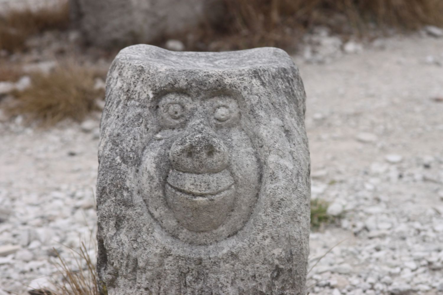
I usually head through Tout Quarry instead of following the official coast path so I do this once again. The limestone from this quarry was used for St Paul's Cathedral and Buckingham Palace. Not to be outdone I pocket a few bits of limestone for myself. The quarry is now disused and contains a sculture park which is well worth visiting and is also a nature reserve. I spend a bit of time photographing some of the sculptures.
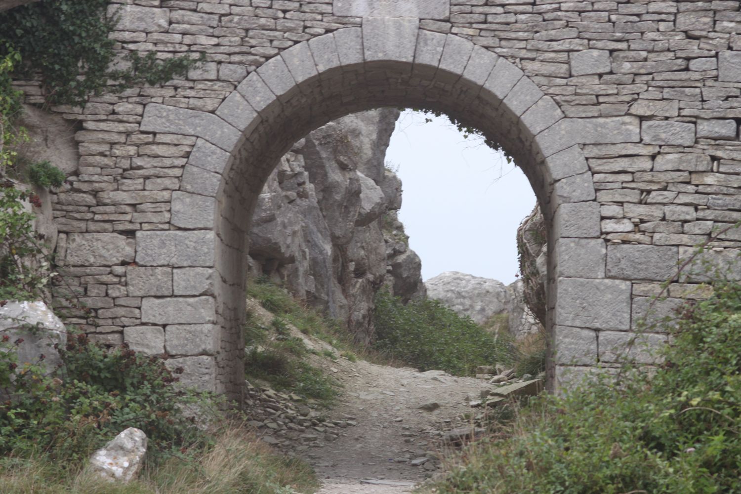


I regain the official coast path after exiting the quarry and head along the cliffs towards Portland Bill. The coast path should run along the cliff tops at West Cliff but subsidence has closed the path here and there is a diversion inland. The diversion didn't last for long and was soon back on the clifftops. The path passes between a disused lighthouse and the National Coastwatch Station and heads down the grassy slopes towards the red and white lighthouse at Portland Bill where the Lighthouse Visitor Centre can be found. A few clumps of feathers lie amongst the grass as if someone has recently made a killing here.
red and white lighthouse
pulpit rock
Pulpit Rock stands offshore so I spend a bit of time exploring the rocky shore as well as recording some video and audio and munching on a sandwich.
The place is deserted and I've never seen it so quiet.
The path continues past loads of beach huts. One of these huts could cost you around £25000! A fat and rather guilty sparrowhawk is perched on one of the beach huts!
The path then changes direction to head roughly north up the eastern side of the Isle of Portland. It heads along quarried cliffs where a couple of hand cranes can be found as well as Cave Hole, a large cave with a blow hole where I recorded some more video.
beach huts
coombefield quarry
After navigating more quarry works the coast path continues along a grassy verge beside the road and reaches Coombefield quarry which is still in use.
The path reaches a viewpoint at Cheyne Weare. A sign here claims that I can see the chalk coastline along Weymouth Bay, the Purbecks, St Albans Head near Swanage and Lulworth Cove. Dream on!! All I can see is mist.
mist at cheyne weare
The path continues down to Church Ope Cove. I pause to admire the beach huts here before climbing back up some steps to reach a viewpoint.
church ope cove
The path continues past Broadcroft quarry and reaches Portland Young Offenders Institution and then Verne Citadel, now used as a category C men's prison.
wallabies
I pass a sign pointing to King Barrow Quarries before encountering some wallabies!!
A tunnel leads to Verne High Angle Battery, a derelict fort built in 1892. From here the coast path seems to take a new route - either that or I've never found it before - and looks over a misty Castletown before descending to what seems to now be called Osprey Quay. Needless to say, I didn't encounter any Ospreys!
castletown
I head back along the track next to the noisy A354 to reach the end of the walk back at the car park at Ferrybridge.
FLORA AND FAUNA
Flora and fauna encountered on the walk today includes :-
- lots of swallows
- lots of snails
- fox moth caterpillars
- sparrowhawk
- great tit
- rose hips
fox moth caterpillar
Podcast
The podcast of today's walk is now available. You can subscribe via the iTunes store or listen using the player below.

MARKS OUT OF TEN?
According to my phone I've walked 13.5 miles today which amounts to 29068 steps. The weather has been excellent for walking if a little on the dull side when it comes to views. 7 out of 10.

View isle of portland in a larger map
lighthouse