outer hope to torcross

south west coast path

11th may 2014

Today's weather forecast looks to be pretty good with maybe the odd shower but mostly sun all day and it looks like the wind has died down a bit.

Dartmouth high tide 16:42

Dartmouth low tide 09:59

The beginning of the day sees me back in Outer Hope next to the Hope and Anchor Inn, where I follow the road and a path through the village to reach Inner Hope. I climb some steps out of Inner Hope and follow a woodland path out on to the open slopes leading to Bolt Tail where I enjoy the views across Hope Cove.

outer hope

inner hope

view across hope cove

I walk around the headland and then climb Bolberry Down at 395 feet. The path continues before dropping steeply from Cathole Cliff into a valley where a footbridge crosses Soar Mill Cove.

soar mill cove

I walk along The Warren where I enjoy the views back to Bolt Tail. Last time I was here it was covered in thick fog and I could barely see anything but today the weather is sunny so I reach Bolt Head without any mishaps. I pause to admire the views here before continuing along the path.

looking back to bolt tail

bolt head

I cross a stream using a stone slab to reach Starehole Bay and climb a steep slope followed by some stone steps to reach Sharp Tor with some fine views towards Salcombe.

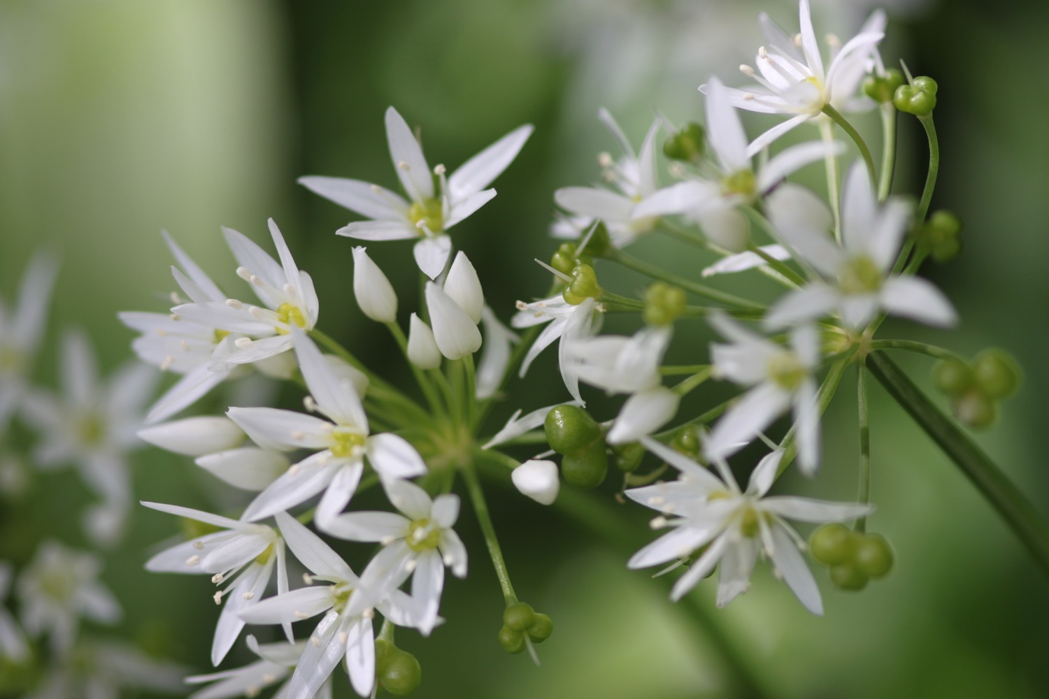
The path continues through woods before reaching a dirt road. It's a lovely walk here and there are wildflowers everywhere.

A proper road continues to the beach at South Sands. I continue on the road, first rising uphill and then down to North Sands Beach, where I pass some red hot pokers, before rising up and down again to reach Salcombe.

south sands

north sands

red hot pokers

I walk around to the Ferry Inn (@TFISalcombe) and climb down to the jetty where I catch the ferry over from Salcombe to East Portlemouth and come ashore at the Venus Cafe. I turn right and follow a minor road to reach Mill Bay, where I enjoy find views back across to Salcombe.

ferry inn

salcombe

mill bay

I walk on towards Gara Rock. There are bluebells everywhere! 

bluebells

I cross a footbridge by a crumbling ruin and the path eventually leads to Gammon Head, given to the National Trust by the Rose family on the 5th of January 1965. The path zig zags to reach Prawle Point National Coastwatch Station but is poorly signposted so I get lost. Eventually I find my way to the car park at East Prawle.

The path passes in front of Maelcombe House before reaching Lannacombe Beach. I avoid falling down the crumbling cliff at The Narrows where I find my one and only orchid of the day. I'm clearly not looking out for them properly!

lannacombe beach

orchid

I head round Start Point and pass the Start Point Lighthouse.

start point

I follow the path down a steep slope to reach Hallsands. I last walked through here in April 2012 and, shortly afterwards, in May 2012, an access road, viewing platform and two houses were affected by a 200 tonne landslide. I wander down to the viewing platform to assess the damage.

view from hallsands viewing platform

The path continues to Greenstraight Beach and then on to Tinsey Head before dropping down to Beesands. I walk along the road at Beesands to reach the Cricket Inn (@TheCricketInn), birthplace of the Rolling Stones, where I stop for a pint of Otter Brewery's (@otterbreweryOtter Bitter and then continue on my way past St Andrew's Church.

cricket inn

I inspect the storm damaged beach at Beesands before heading off towards Torcross.

storm damaged beesands

A short walk takes me to Torcross where I climb down steps, admiring the view across Slapton Sands, to reach the promenade and the end of my walk. I walk past the Start Bay Inn (@StartBayInn) and the Sherman tank, honouring the memory of servicemen, and head in to the car park where my lift awaits.

torcross

start bay inn

Torcross and Slapton Sands also took a battering in this winter's storms, although most of the damage has been cleared now

In 1943, Torcross and the surrounding area was evacuated so that Slapton Sands could be used as a training area in preparation for the D-Day landings. This video tells the story of the evacuation all those years ago in the words of seven local residents who were children at the time.

FLORA AND FAUNA

Flora and fauna encountered on the walk today includes :-

  • skylarks
  • woodpeckers
  • bluebells
  • wild garlic
  • red campion
  • red hot pokers
  • little egret
  • one orchid
  • navelwort
  • dead nettles

PODCAST

The podcast of today's walk is now available.  You can subscribe via the iTunes store or listen using the player below.

MARKS OUT OF TEN?

Phew! What a trek!! According to my phone I've walked 26.2 miles today which amounts to 46914 steps. Although it has been a blustery day (nothing like yesterday though) the weather has been fantastic, the rain stayed away and the walking has been great. 9 out of 10.


View outer hope to toreros in a larger map

bolt tail

heron's rest to torcross

south west coast path

10th may 2014

We're staying this week in a cottage called Heron's Rest, thanks to Classic Cottages. The cottage is set in a peaceful location, high above the Dart valley overlooking Dartmouth.

The weather forecast for today has been dreadful (but getting progressively better) all week and after heavy overnight rain it looks like I've got a thoroughly nice spring day to look forward to. Could be a bit blustery though.

Dartmouth high tide 15:49

Dartmouth low tide 08:59

tide times.jpg

After packing my bag, I leave Heron's Rest for the walk through Long Wood down to the ferry crossing over the River Dart to Dartmouth. It's a lovely Spring day so I take advantage and photograph some of the spring flowers.

long wood

Just before leaving Long Wood I come across a sign warning of basking adders. Unfortunately the day is still young and so hasn't warmed up yet so I don't come across any.

After the delightful walk through Long Wood I reach the bank of the River Dart and catch the Higher Ferry (I was robbed of 50p for the crossing!) over to Dartmouth.

I amble through Dartmouth passing the Floating Bridge Inn and come across a Morgan Roadstar Brooklands Edition car parked on the waterfront.

morgan roadstar brooklands edition

warfleet creek

I continue ambling through Dartmouth passing the Ship in the Dock Inn, the Windjammer Inn and the George and Dragon before walking along the cobbled waterfront, passing Bayards Cove Inn and then through Bayards Cove Fort, a small Tudor artillery fort guarding Dartmouth's inner harbour. I climb steps to leave the waterfront and head through Warfleet Creek and towards St Petrox Church.

st petrox church

From here I head next door to Dartmouth Castle which, for over 600 years, has guarded the narrow entrance to the Dart estuary.

The path zig zags out towards Blackstone Point, Coombe Point and then Warren Point, passing secluded coves on the way before heading inland to reach a minor road. This road leads to the A379 which takes me in to Stoke Fleming where I pass the Green Dragon and St Peter's Church.

st peter's church

green dragon

I follow the A379 (think I've gone the wrong way!) out of Stoke Fleming and on to Blackpool Sands where I have a potter around the shingly beach. The Venus Beach Cafe can be found here.

blackpool sands

king's arms

I leave Blackpool Sands via a lovely woodland path and cross a steep grassy valley and then a rather circuitous route (needless to say I got lost!) to reach Strete where I pass the King's Arms (it seems to be closed and is to let) and see St Michael's Church in the distance.

woodland flowers

I follow the A379 out of Strete before a path takes me down to the Strete Gate picnic site from where I drop down onto Slapton Sands. I trudge along the beach which starts off sandy but soon becomes more shingly.

slapton sands

The wind has been blustery all day but seems to turn into a gale here and I can barely stay on my feet so I head back to the main road to try and find some relief, cross it, and drop down to a path that follows the road in front of Slapton Ley. There isn't any relief!

torcross

From here it should be an easy walk to the car park at Torcross, the destination for today's walk. Unfortunately, today it isn't an easy walk so I stumble around in the wind until I reach the car park where I shelter in a hide overlooking Slapton Ley for a bit.

slapton ley

I leave the shelter of the hide, head past the Sherman tank at the entrance of the car park and on to the Start Bay Inn (@StartBayInn) where I enjoy a yummy pint of Otter Brewery's Otter Ale.

otter ale

I leave the shelter of the hide, head past the Sherman tank at the entrance of the car park and on to the Start Bay Inn (@StartBayInn) where I enjoy a yummy pint of Otter Brewery's Otter Ale.

FLORA AND FAUNA

Flora and fauna encountered on the walk today includes :-

  • owls
  • magpies
  • no adders
  • chaffinches
  • robins
  • wrens
  • thrushes
  • empty snail shells
  • skylarks
  • bluebells
  • wild garlic
  • swallows
  • red campion

PODCAST

The podcast of today's walk is now available.  You can subscribe via the iTunes store or listen using the player below.


MARKS OUT OF TEN?

According to my phone I've walked 16 miles today (much further than I was expecting) which amounts to 32396 steps. Despite the wind for most of the day it has been a great day's spring walking with plenty of interest to see throughout the day. 9 out of 10.


View heron's rest to torcross in a larger map

bridport farmers' market

south west coast path

11th january 2014

west bay

weather forecast.jpg

Today's weather forecast looks like it will be fantastic, especially considering the amount of rain we've had recently, and does, indeed, turn out to be bright, sunny and warm. Must make the most of it as it doesn't look like it will last vey long.

Today is Bridport Farmers' Market day which is a perfect excuse for heading out to the South West Coast Path at West Bay. The farmers' market is held on the second Saturday of every month in the Arts Centre (@BridportArts).

bridport farmers' market

Producers attending the market today included :-


First up is a wander around Bridport (including stocking up on supplies at Leakers Bakery (@leakersbakery)), exploring the saturday market and along the way passing The Ropemakers, the George Hotel, the Woodman Inn, The Greyhound, The Bull Hotel and The Hope & Anchor

After that I head out to West Bay along the Monarch's Way to join the South West Coast Path. It's pretty muddy out so I squelch along the fields at a very slow pace before reaching Park Dean Holiday Park at West Bay.

west bay

After exploring West Bay for a bit - passing the George Hotel and The West Bay Hotel - I trudge along the beach to reach Freshwater Beach Holiday Park, enjoying the mild January weather.

west bay beach

Here I head inland slightly, walking through the holiday park - it's pretty dead at this time of year - and then through fields to reach Burton Bradstock. I turn left to walk through part of the village and then head towards St Mary's church. I cross the stream that burbles away here and then cross fields  to reach Hive Beach.

burton bradstock

st mary's

Often I'll continue walking along Cogden Beach before doubling back on myself, crossing fields to reach the National Trust car park above Cogden but today is a short walk day so I end my walk by the Hive Beach Cafe, which is closed this week for annual maintenance but is open for business again on Monday.

hive beach at burton bradstock

FLORA AND FAUNA

Flora and fauna encountered on the walk today includes :-

  • sheep
  • robins
  • lots of dogs
  • lots of gulls
10 out of 10.png

MARKS OUT OF TEN?

I've walked about 5.5 miles today. My pedometer app failed me again but it should be about 12000 steps.

Love Bridport.

Love West Bay.

Gorgeous weather.

10 out of 10.

We'll be back next month.


View bridport to burton bradstock in a larger map

I didn't do any recording today but below is a recording from farmers' market day back in October. It includes recording from Bridport itself, Bridport Farmers' Market, the river behind Palmers Brewery, West Bay, Harbour Amusements in West Bay, West Bay beach, St Mary's Church, Burton Bradstock and Hive Beach at Burton Bradstock.

west bay beach

west bay beach

exmouth to seaton

south west coast path

3rd october 2013


Today's weather forecast looks to be on the ropey side.

Turns out it was worse than forecast. It started raining heavily just before I reached Budleigh Salterton, I walked through a thunderstorm while going through Budleigh Salterton. After that the weather turned much worse and I walked through another big storm while going through Sidmouth and beyond. 

The rain finally relented just before I reached Branscombe and then it turned into rather a nice afternoon. By then I was soaked though! 

weather forecast.jpg

Today's walk starts at Exmouth and since there's a nice, sandy beach here I might as well stroll along it for a bit. I couldn't find any signs so lucked upon the coast path by going through Foxholes Car Park just before Orcombe Red Rocks.


exmouth

orcombe red rocks

A path rises out of Exmouth to reach High Land of Orcombe and the start of the Jurassic Coast, a World Heritage Site stretching 95 miles from here right the way around to Dorset. A sign gives details of the Jurassic Coast and a Geoneedle can also be found which was unveiled by His Royal Highness the Prince of Wales, in 2002. The Geoneedle is constructed from a variety of different stones, representing both the major building stones to be found on the Jurassic Coast and the sequence of rocks that form this part of the coastline.

jurassic coast sign

geoneedle

geoneedle

I stay up on the cliffs passing the Devon Cliffs Holiday Park and the Beachcomber Bar before dropping down onto the beach just before Straight Point. The Royal Marine Ranges is found on Straight Point and they were practising today so a lot of gunfire was disturbing the tranquility. I climb back onto the cliffs, passing the rifle range, to reach Littleham Cove where there should be some fine views of the lovely crumbling red sandstone cliffs but it was a bit misty and the sea was red with sand.

beach and rifle range

littleham cove

I keep well away from the edge of the crumbling cliffs and climb onto Beacon Hill. A trig point is found showing the height to be 423 feet.

The path continues through some woodland and it is around here that it started chucking it down so I had to don my waterproofs. A tarmac path leads in to Budleigh Salterton and its pebbly beach. It was still chucking it down so I saw very little of Budleigh Salterton except for a shelter which I stayed in for a few minutes as a thunderstorm passed by.

budleigh salterton

budleigh salterton

I head along the sea front in the pouring rain but can't see very much.

The River Otter and the Otter Estuary Nature Reserve are reached so I turn inland in order to cross the River Otter via a road and then head back to the coast over the other side of the river. I don't see any otters but there are plenty of noisy geese here. There should be some fine views back to Budleigh Salterton but it's still chucking it down and still a bit misty.

view back to budleigh salter ton

More red sandstone cliffs are climbed and the going from here to past Sidmouth is going to get pretty rough. Another holiday park is encountered at Ladram Bay and a series of red sandstone stacks can be seen offshore.

ladram bay

There are lots of grassy slopes here including at Peak Hill but the path eventually reaches a road which drops in to Sidmouth

As I make my way through Sidmouth it is blowing a gale as well as tipping down with rain so I duck inland a bit to try and get some shelter. It's not the weather for photographs!

After enjoying the delights of a wet and windy Sidmouth I cross a bridge over the River Sid before climbing back onto the cliffs via a tarmac path. It's quite a climb up here (525 feet) but there are some benches at the top to rest and admire the view. Well, I admired it last time I was here in 2005 but there's not much to be seen today. 

view back to sidmouth

The path continues past South Combe Farm and down some steps to Salcombe Mouth where there is a pebbly beach. The coast path however, heads inland before climbing up on to the cliffs again at Higher Dunscombe Cliff. Even on this filthy day the views are spectacular. Here can be found the Weston Plats where, in the 19th century, thanks to the unique micro-climate on these cliffs, local residents were able to produce early crops of flowers, vegetables and strawberries.

view from the cliffs

weston mouth

After a walk along the clifftops the path descends on some steps to the beach at Weston Mouth. The path climbs steeply yet again to the top of Weston Cliff and then passes Weston Wild Flower Meadow. Unfortunately it's the wrong time of year now to enjoy the butterflies but if I came at the right time I could see Brimstones, Orange Tips, Skippers, Common Blues, Marbled Whites, Meadow Browns, Painted Ladies, Clouded Yellows and Red Spotted Burnets.

The path ducks inland at Coxe's Cliff before heading over grassy clifftops and descends once again, this time to Branscombe Mouth. The 62,000 tonne container ship MSC Napoli was beached here in January 2007 after experiencing difficulties during a storm.  After containers started to get washed up on the beach, scavengers started arriving to 'recycle' the contents. Unfortunately there are no longer any spare motorbikes lying around! The anchor of the ship, weighing 14 tonnes, was presented to the people of Branscombe by the ship's owners and was installed here in July 2008.

msc napoli anchor

branscombe beach

The weather has now vastly improved so I'm able to enjoy the beach here before another climb takes me to the top of East Cliff and I enter another caravan park, the Sea Shanty Caravan Park and then the coast path heads through the Hooken Undercliff, formed in 1790 by a slump in the chalk cliffs. I'm thankful for the undercliff as it saves me a hefty hike to the top of the cliffs.

hooken undercliffs

hooken undercliffs

I zig zag back up to the top of the cliff and round Beer Head before reaching the village of Beer. The Anchor Inn is on the seafront at Beer, just by the slipway, but seems to be lacking any signage whatsoever today. I continue to reach the Jubilee Memorial Grounds before joining a road.

beer

beer

Following exceptionally wet weather in 2012, there was a cliff fall severing part of Old Beer Road along  which the South West Coast Path used to run. As a result Old Beer Road is closed for walkers. It looks like a new route is being completed as I'm diverted through some woods to reach the other side of Old Beer Road. From here I trudge wearily into the destination for today, Seaton. It's been a long day!


FLORA AND FAUNA

Flora and fauna encountered on the walk today includes :-

  • noisy geese
  • little egrets
  • kestrels
  • no otters

Podcast

The podcast of today's walk is now available.  You can subscribe via the iTunes store or listen using the player below.

podcast logo small.png

MARKS OUT OF TEN?

According to my phone I've walked a whopping 24 miles today which amounts to 51851 steps. Despite the atrocious weather for most of the day it has been a great day's walking with plenty of interest to see (or not) throughout the day. 9 out of 10.


9 out of 10.png

View exmouth to seaton in a larger map

exmouth

swanage to south haven point

south west coast path

1st october 2013


The weather forecast for today looks to be a bit on the gloomy side again. This turns out to be true but with the wind blowing, doesn't feel as warm as promised.

weather forecast.jpg

Today's walk, at 7.5 miles (according to Paddy Dillon's South West Coast Path book), is the shortest walk on the South West Coast Path and, unless I dawdle, shouldn't take me longer than 2-3 hours. I start off by walking along the High Street and then the promenade to leave Swanage passing the Ship Inn, the White Swan and the Red Lion pubs.

swanage

beach huts

I walk along the beach until I reach a beach cafe below The Grand Hotel where I climb some stairs to reach the cliff top. I'm then forced to follow a series of roads to reach Ballard private estate. From here I reach another sandy beach before climbing up to the clifftop and head across Ballard Down to reach Ballard Point.

a misty ballard down

old harry rocks

Below can be seen loads of pinnacles and stacks including Old Harry Rocks. These are all that remain of what was once a large stretch of chalk between Purbeck and the Isle of Wight.

I head on around Handfast Point and onwards towards Studland, dropping down on to South Beach. Somewhere just offshore can be found seahorses. Despite this, Studland Bay was dropped as one of the potential Marine Conservation Zones recently.

south beach

The route out of South Beach seems to be closed because of a landslip so I head inland to Studland, passing the Bankes Arms Country Inn and the Isle of Purbeck Brewery (more use of Flash on their website I'm afraid) from which emanates a lovely smell of beer. I pass the Manor House Hotel, which is currently closed for refurbishment, to reach Middle Beach.

bankes arms country inn

isle of purbeck brewery

From here it's a two mile stroll along the beach to reach South Haven Point.

WARNING - part of the beach is given over as a naturist beach. It was blowing a gale and felt pretty cold so there weren't many hardy souls out today!

naturists warning

middle beach

And that's it really! I remove my boots and socks and paddle my way along the beach to reach the end of the South West Coast Path at South Haven Point. Well, in my dreams! I suspect the water was pretty cold today. At South Haven Point I take time to photograph the sculpture marking the end of the path.

south haven point


FLORA AND FAUNA

Flora and fauna encountered on the walk today includes :-

  • lots of sea weed
  • sea horses
  • razor clams
  • swallows
  • cormorants
  • seagulls
  • sweet chestnuts
  • oaks


Podcast

The podcast of today's walk is now available.  You can subscribe via the iTunes store or listen using the player below.

podcast logo small.png


MARKS OUT OF TEN?

According to my phone I've walked 9.5 miles today which amounts to 20459 steps. The weather has been excellent for walking if a little on the dull side when it comes to views. 7 out of 10.

7 out of 10.png

View swanage to south haven point in a larger map

swanage