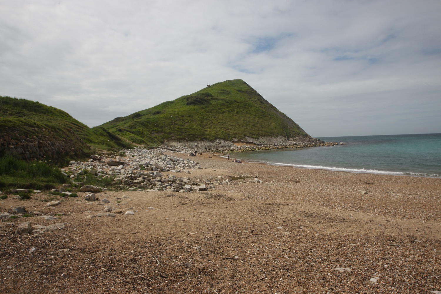
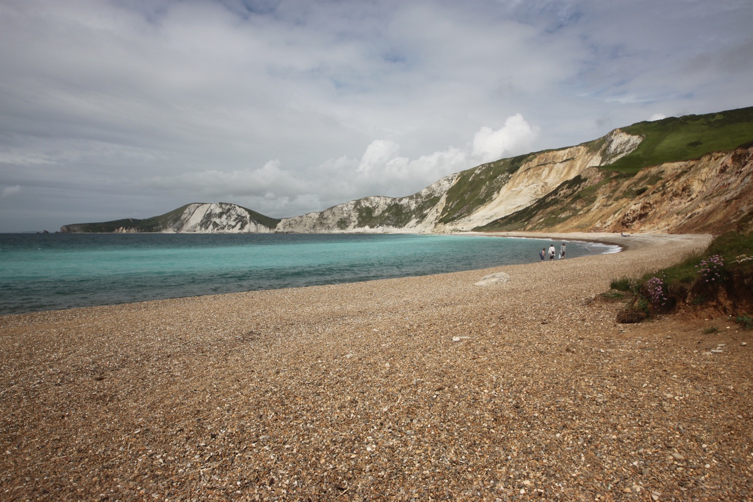
worth matravers to south haven point

SOUTH WEST COAST PATH

tuesday, 6TH june 2017

Today's weather forecast doesn't look very good and I could be in for a very blustery day. For some reason the wind speeds on my weather forecast app are completely different on my iPhone and iPad. It has not been a good week for reliable technology.

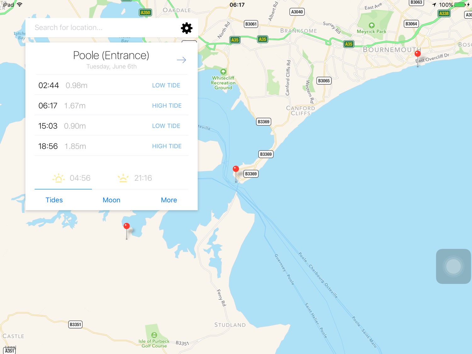
Poole high tide 06:17

Poole low tide 15:03

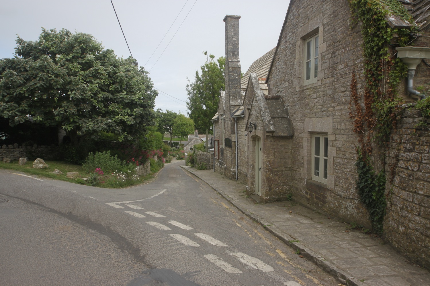
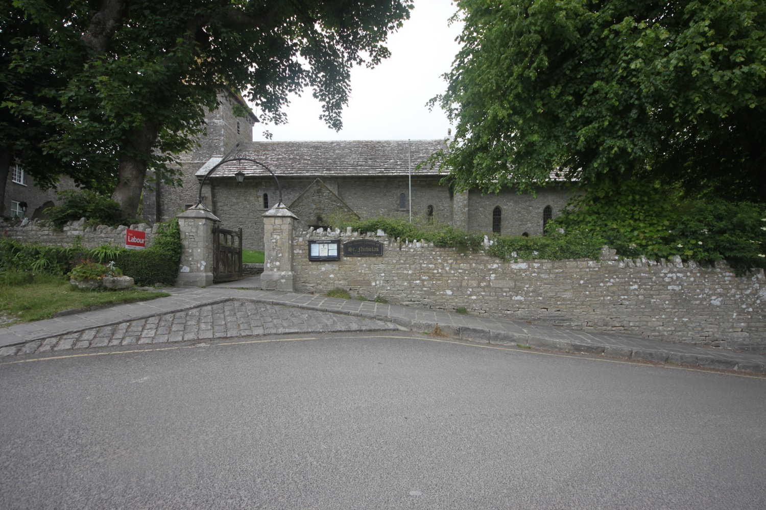
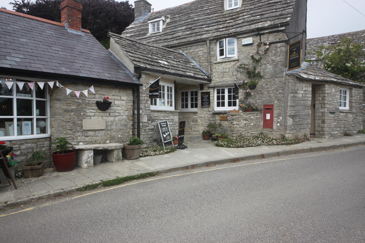
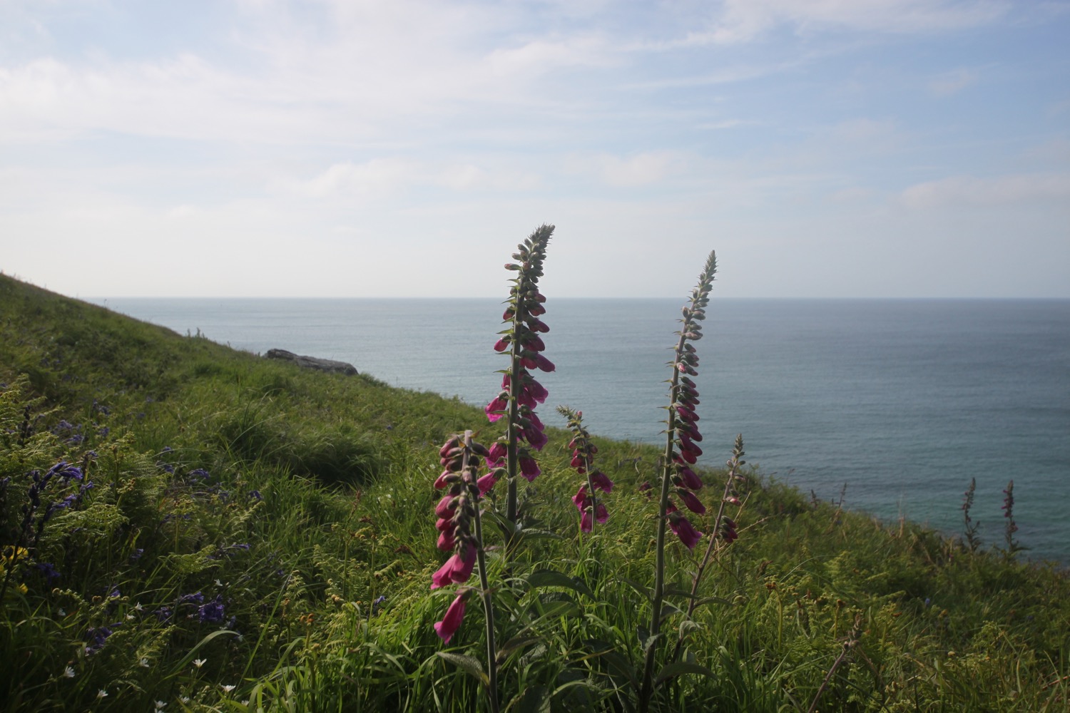
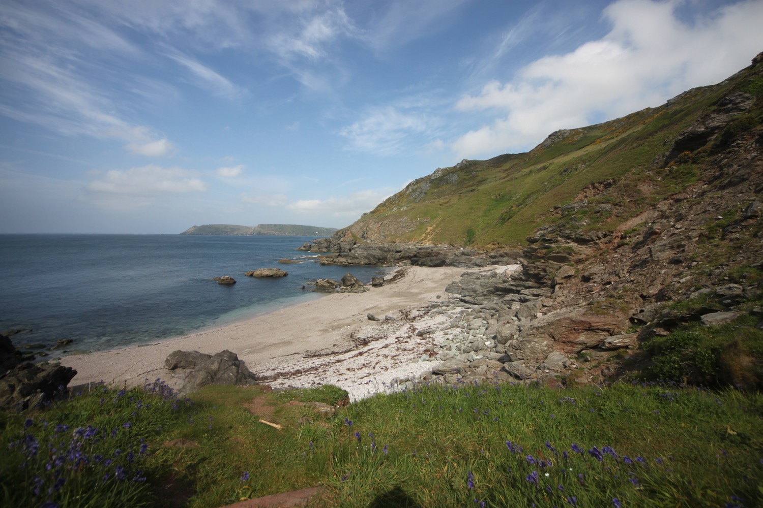
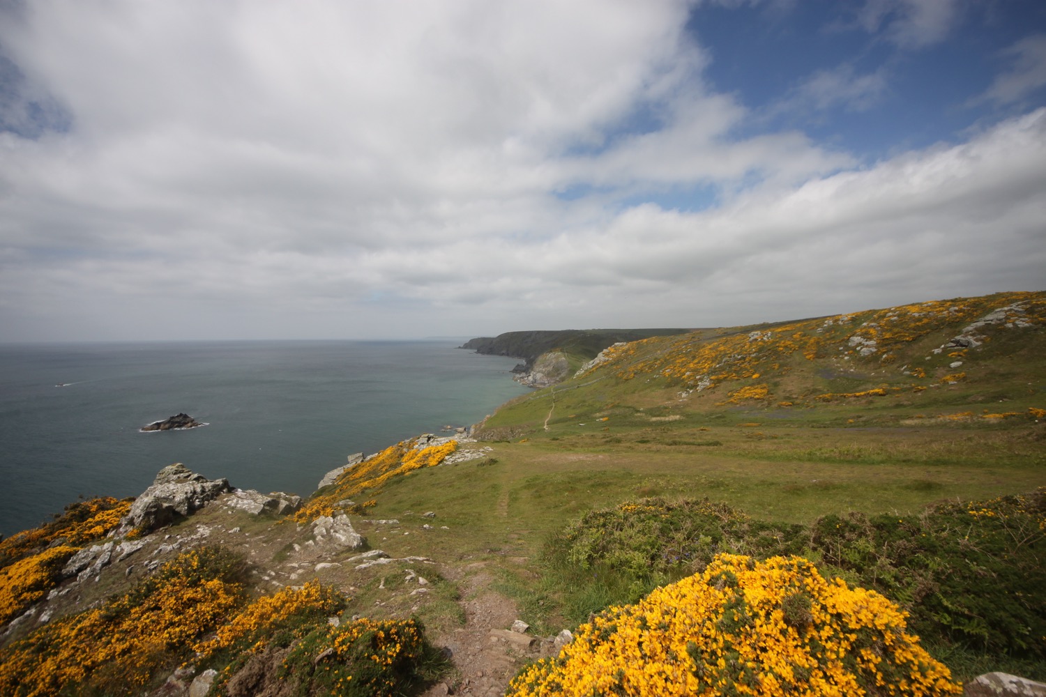
I start the day back at the Square and Compass pub in Worth Matravers and it is indeed a blustery start to the day.

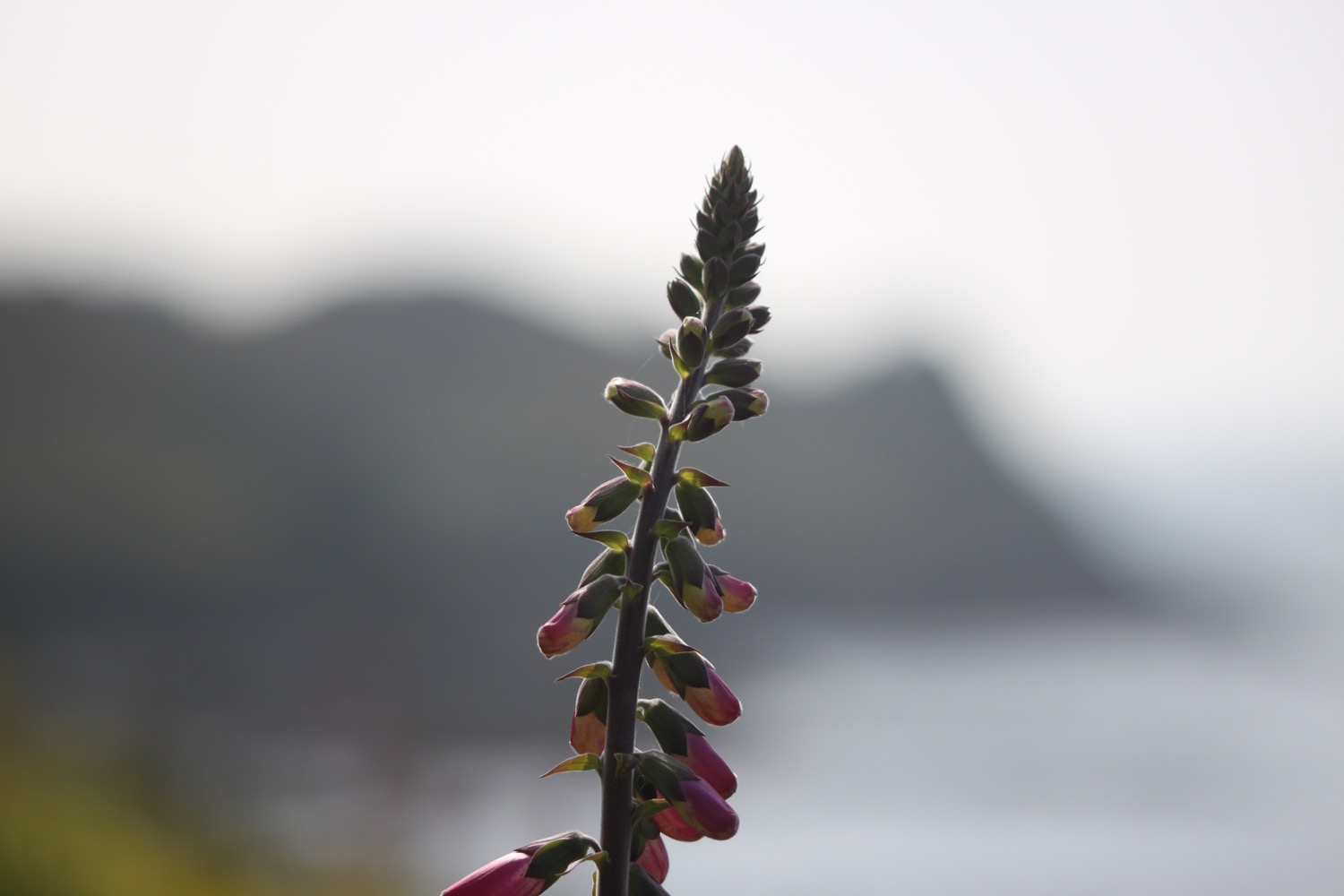
It is clear as soon as I reach the coast that things are awry and the weather is a lot worse than either of my forecasts suggests and I get blown off of my feet several times in the blasting wind on the path to St Aldhelm's Head. This is far too dangerous to walk in.

I make it, somehow, to St Aldhelm's Chapel and, fortunately, the door is open so I shelter inside for 15 minutes hoping that the winds will die down. They don't so the tough decision is made to abandon the walk. This is the first time I've ever abandoned a walk.

I head along a track inland that takes me back to Worth Matravers.

inside st aldhelm's chapel

lulworth cove to worth matravers

SOUTH WEST COAST PATH

sunday, 4TH june 2017

Today's weather forecast looks to be pretty good although those temperatures don't look particularly high.

Mupe Bay low tide 08:15

Mupe Bay high tide 16:21

The last time I walked over the Lulworth Ranges was 5 years ago and it was a filthy day. The rain was literally washing the coast path away as I was walking along it and a huge stretch of the coast path was closed shortly afterwards and for a long period of time. Time has passed though and the coast path is back open now.

I start the day back at the car park above Lulworth Cove and wander down through Lulworth village passing the Lulworth Heritage Centre. I head out to Stair Hole and enjoy the views across the magnificent Lulworth Cove before descending across the old village green. 

stair hole

lulworth cove

I head down to enjoy the beach and I'm not the only person doing the same thing. It is a beautiful early summer's morning.

lulworth cove beach

The coast path seems to have been re-routed since the last time I was here and I follow signs through West Lulworth village and more signs point inland before I climb up Bindon Hill and head off across grassy slopes. I'm now high above Lulworth Cove and I climb gingerly down some steep stone steps. The heavy back pack isn't helping. I come across a lone pyramidal orchid about half way down.

high above lulworth cove

pyramidal orchid

I reach a beach at the bottom and realize that instead of taking the rather long detour inland I could have just walked across the beach at Lulworth Cove to get here.

 I climb out of Lulworth Cove and have magnificent views back to Lulworth Cove from the top of Pepler's Point (not marked on my map).

view over lulworth cove

I reach Fossil Forest Gate and detour down to the right to explore the Fossil Forest, consisting of strange rounded shapes known as 'algal burrs' but a cliff fall has meant that access is currently closed. I can still make out some of the fossilized trees down below me.

closed!

fossilized trees

It's now time to enter the Lulworth Ranges at Fossil Forest Gate. I'm always worried that I've got my dates wrong and find that the gate is closed but, happily, it's open.

I can make out some more of the fossilized trees down below me from a bit further along the coast path.

more fossilized trees

I walk along a grassy path enjoying the lovely wildflowers before passing a radar station.

I have lovely views over Mupe Bay where I come across a large patch of common spotted orchids

mupe bay

I round Mupe Bay and climb a lot of steps up the massize cliff here. I come across another lone pyramidal orchid and then a lone bee orchid.

I continue along the clifftops where I come across burnet butterflies feeding on viper's-bugloss and the slopes below me are covered in orchids, quite happily growing amongst the military shrapnel.

Signs warn me not to touch any military debris as it may explode and kill me but cows below me don't seem to be triggering any explosions. I can see burnt out tanks and other vehicles down below.

It is then a steep descent down to the beach at Arish Mell which I can easily get to but signs warn me that it is off limits. What a shame.

arish mell

I climb steeply out of the cove and come across plenty more orchids.

I now have magnificent views back from where I've come from before I amble inland away from the cliffs.

It has turned into a beautiful morning and is starting to get pretty hot. Much hotter than the weather forecast said it would. The weather was so bad last time I was here that I managed to follow the wrong path and ended up in Tyneham village. The army commandeered the village and the surrounding area in 1943 and forgot to give it back at the end of the war.

Fortunately, weather conditions are much better today and I manage to find the correct path easily and head through the ramparts of the Iron Age fort, Flower's Barrow, gradually falling into the sea.

I leave the hillfort through a gap in the ramparts and wander steeply downhill to Worbarrow Bay where I come across a patch of flag iris and some big clumps of sea thrift.

I drop down to the shingle beach and wander along it for a bit. It's rather lovely here and quite a few other people agree even though the beach is in the middle of nowhere.

I walk back up the beach and cross a footbridge before climbing back up the cliffs.

I now have fine views over Worbarrow Tout before walking along the clifftops at Gad Cliff where I pass Wagon Rock. The wildflowers are looking lovely on the cliffs and I have lovely views over the countryside down to Tyneham.

I pass Brandy Bay and Hobarrow Bay and head down through fields full of cows. My walk through the ranges is over so I leave through the exit gate at the start of Kimmeridge Bay. 

I immediately come across Kimmeridge Wellsite where I pass the nodding donkey oil pump which has been pumping oil since 1959. 

nodding donkey

I head around Kimmeridge Bay where a field trip is taking place, passing the Purbeck Marine Wildlife Reserve and Fine Foundation Marine Centre.

kimmeridge bay

purbeck marine wildlife reserve

I climb steep steps up to Clavell Tower, a grade II listed Tuscan style tower built in 1830 and owned by the Landmark Trust. It was painstakingly moved, piece by piece, inland 25 metres away from the crumbling clifftop starting in 2006.

clavell tower

It is now an uneventful walk across the cliffs along fiddly, overgrown and windy paths. I walk up and downhill, crossing footbridges and navigate a tricky stretch of the path at Houns-tout cliff where I encounter a waterfall which doesn't seem to have any water. The cliffs are covered in wildflowers but there's also rather a lot of nettles.

I come across a small patch of bee orchids just coming into flower.

I climb some steep steps up a wooded cliff to reach a stone seat overlooking the sea. I have magnificent, if rather grey now, views.

I'm now high above the rather beautiful Chapman's Pool. Five years ago it was howling a gale and hammering down with rain when I got here and I had to help a couple of fellow walkers down the steps as they couldn't stand up in the wind. It's a much more peaceful day today!

chapman's pool

It looks rather difficult to get down to the beach at Chapman's Pool, especially with a heavy back pack, but there are a few hardy souls down on the beach.

I descend down the steep flight of stone steps down to the fields behind Chapman's Pool. The coast path heads inland across fields to come across a minor road with a small car park nearby at Renscombe Farm.

This must be the road that takes me into Worth Matravers so I follow this road to reach my destination for the day the rather busy Square and Compass pub.

square and compass

I head up the road slightly to the rather large car park for a rather small village. It is packed though! What a lovely day's walking.

FLORA AND FAUNA

Flora and fauna encountered on the walk today includes :-

  • a yellowhammer
  • small copper butterflies
  • wall brown butterflies
  • red valerian
  • common bird's-foot trefoil
  • pyramidal orchids
  • common spotted orchids
  • bee orchids
  • six-spot burnets
  • viper's-bugloss
  • skipper (presumably dingy) butterflies

PODCAST

The podcast of today's walk is now available. You can subscribe via the iTunes store or listen using the player below.

MARKS OUT OF TEN?

According to my phone I've walked 14.8 miles today which amounts to 35552 steps. It has been another beautiful day's walking today. Ten out of ten!

Hmmm. My Ordnance Survey app is definitely playing up. There's no way that this graph is representative of the up and down route today. The total ascent today has been an alleged 200 metres or 656 feet.

MAP

lulworth cove

pyramidal orchid

orchids

bee orchid

clavell tower

beach collection

ferrybridge to lulworth cove

SOUTH WEST COAST PATH

saturday, 3rd june 2017

Today's weather forecast looks to be great, although not as warm as it should be at this time of year.

Lulworth Cove low tide 07:13

Lulworth Cove high tide 15:22

The walk begins at the Chesil Beach Visitors Centre located at the Ferrybridge car park. The road onto the Isle of Portland is extremely busy so I quickly cross the road and drop down onto the trackbed beside the road which used to be a railway line.

chesil beach visitors centre

I immediately come across wildflowers and butterflies. It's going to be a good day!

I amble along the track next to the road heading for Weymouth before reaching the start of the Rodwell Trail, opposite the derelict Ferrybridge Inn, which is a walking and cycleway (the trail not the pub!) and part of the National Cycle Network Route 26. I have lovely views over to the Isle of Portland and ahead to Weymouth.

view over to portland

view ahead to weymouth

There are a series of markers on the Rodwell Trail every 500 metres, each with a symbol representing a creature, plant or historical feature. I won't be going all the way into Weymouth but I'll catch as many of the markers as possible. The first marker at the start of the trail shows a Whitehead Torpedo. These used to be built in a nearby factory where houses now stand. 

whitehead torpedo

I amble along the trail and come across the next marker, showing the old Ferrybridge railway bridge that used to cross the Fleet.

ferrybridge railway bridge

The next marker shows the rare 'Little Robin' flower that can be found on the trail.

little robin flower

Next up is a marker showing Weymouth's RNLI lifeboat, 'Ernest and Mabel'.

ernest and mabel

The final marker for me is one showing Henry VIII who built a lot of defences around here.

henry viii

It's time for me to leave the trail and I turn right close to a railway cutting next to a coast path marker and drop from the old railway track down to the coast path.

I have magnificent and sunny views over to the Isle of Portland and over the breakwater and Portland Harbour.

I follow a road inland and pass the ruins of Sandsfoot Castle in its park.

sandsfoot castle

I amble through the park, full of dog walkers, and then continue along the road, passing the entrance to Castle Cove Beach which is covered in rubbish and seems to be closed due to a landslip.

I continue along Marine Terrace and then Belle Vue Road and Bincleaves Road and then walk over Bridge Sea Wall at Newton's Cove. I have more lovely views over to Portland.

view over to portland

I walk along a grassy area above the cliffs and head into Nothe Gardens where I amble along the paths heading towards Nothe Fort, built by the Victorians to protect Portland Harbour.

nothe fort

I walk down a set of stone steps to reach the quayside and amble along the harbour, where I pass Weymouth Sailing Club, Weymouth Lifeboat Station, the Old Harbour Dive Centre and the Old Rooms Inn.

I cross the River Wey using the Town Bridge and amble along the other side of the harbour heading towards what was once the ferry terminal. Along the way I pass the Anchor Inn, the Royal Oak, the Ship Inn and the George Inn.

I pass a sign informing me that the Black Death entered England in 1348 through this port and killed 30-50% of the country's total population.

I cross a busy road and drop down onto Weymouth Beach and amble along the curving arc of golden sand, adjacent to the town centre. Even this early in the morning the beach is fairly busy.

weymouth beach

At the far end of the beach I head up onto The Promenade and it is now properly hot. I pass some beach huts at Greenhill Gardens and then pass some benches made of the local oolitic limestone at Preston and Overcombe Beach. 

limestone benches

I pass Lodmoor Country Park and then Lodmoor Nature Reserve. I now have magnificent views back over Weymouth, Portland Harbour and over to the Isle of Portland.

preston and overcombe beach

I should walk along the road, passing the Spyglass Inn and then amble along the low rolling Furzy Cliff but the beach is too tempting so I drop down to the pebby beach and carry along it all the way to Bowleaze Cove.

bowleaze cove

I work my way along paths through Fantasy Island Fun Park  where I cross the River Jordan and I then pass the Riviera Hotel which, as I recall, was closed and a bit of a mess the last time I passed here but has now been fully renovated although it doesn't seem to be very busy.

riviera hotel

I head inland slightly due to landslips before heading out onto Redcliff Point.

I follow the coast path as it meanders inland behind the crumbling cliffs through a field full of buttercups and pass an adventure centre before heading into woods on Black Head on the way to Osmington Mills.

field full of buttercups

I head through a campsite and then turn right onto the road which leads me down to Osmington Mills.

I head through the grounds of the Smugglers Inn before heading back out onto the clifftops. I amble over the top of Hannah's Ledge, Frenchman's Ledge, Pool Ledge, Bran Ledge and Perry Ledge before reaching Ringstead Ledge.

smugglers inn

I have magnificent views back to Weymouth and Portland.

magnificent views

I reach a road and I head behind a car park, a shop and a cafe along a track and then drop down to the shingle beach at Ringstead Bay and enjoy the beach for a while.

ringstead bay

ringstead bay

I head back onto the coast path where a gravel and then grassy track heads up through woods and then on to Burning Cliff, named after a landslip in 1826 triggered an oil/shale fire which smouldered for several years. I enjoy the wildflowers here next to the tracks.

I pass the wooden church of St Catherine's Chapel built by the widow of a controversial vicar of London's Stroud Green, Dr Robert Linklater. The chapel was restored in 2010.

st catherine's chapel

I head behind the chapel onto the crumbling chalk cliffs and out onto the headland at White Nothe. I pass by some old coastguard cottages at 548 feet and head along the clifftops where I have beautiful views along the chalk cliffs towards Bat's Head.

coastguard cottages

view over bat's head

I pass West Bottom and Middle Bottom to reach a grassy hollow at The Warren, enjoying the masses of wildflowers and butterflies along the way.

It is now a rollercoaster ride up and down the chalk cliffs passing the natural arch at Bat's Hole to reach Bat's Head. I head out onto the headland where I have magnificent views back where I've come from and ahead towards Durdle Door and Lulworth Cove.

view from bat's head

view from bat's head

I descend steeply and can see a chalk stack out to sea before climbing steeply at Swyre Head. I descend steeply again at Scratchy Bottom (snigger) and have lovely views over the rock arch at Durdle Door.

durdle door

I gingerly descend steps full of people to reach the lovely Durdle Door Beach which is heaving with people on this beautiful summer's day at the end of half term. I admire the limestone arch at close quarters. I enjoy the busy beach for a while before retracing my steps to regain the coast path.

durdle door beach

durdle door beach

I climb uphill and follow the well worn track full of people which passes a campsite (which explains why there's so many people). The crowds thin out and I climb up a long flight of steps above St Oswald's Bay and I can now see down towards Lulworth Cove.

view over lulworth cove

I pass behind Dungy Head and head down the popular path towards the car park and pass the Lulworth Heritage Centre. I head out to Stair Hole and enjoy the views across the magnificent Lulworth Cove before descending across the old village green.

lulworth cove

I walk back through the village and head back to the car park where my lift arrives just in time to avoid the exorbitant £4 parking fee.

WHAT A DAY!!

FLORA AND FAUNA

Flora and fauna encountered on the walk today includes :-

  • pied wagtails
  • ox eye daisies
  • sea thrift
  • common blue butterflies
  • roses
  • hogweed
  • fennel
  • echiums
  • swallows
  • housemartins
  • chiffchaffs
  • buttercups
  • speckled wood butterflies
  • red admirals
  • wall brown butterflies
  • red campion
  • viper's-bugloss
  • six-spot burnets

PODCAST

The podcast of today's walk is now available. You can subscribe via the iTunes store or listen using the player below.

MARKS OUT OF TEN?

According to my phone I've walked 16.2 miles today which amounts to 37726 steps. It has been an absolutely beautiful day's walking today in gorgeous sunshine. Ten out of ten!

My Ordnance Survey app has failed me today and claims that my total ascent was only 149 metres or 488 feet and shows nothing of the rollercoaster ride at the end of the day.

MAP

view to weymouth

weymouth lifeboat

six-spot burnets

view from bat's head

durdle door

beach collection

salcombe to torcross

south west coast path

wednesday, 10th may 2017

Today's weather forecast looks to be pretty good although I don't like the look of those easterly winds. It could feel a bit cold today.

Salcombe high tide 06:32 and 18:57

Salcombe low tide 12:42

I start the day back in Salcombe and  walk around to the Ferry Inn (@TFISalcombe) and climb down to the jetty where I catch the 08:30 ferry over from Salcombe to East Portlemouth. There's only one other passenger at this time of the morning. The ferry fare is £1.60.

catching the ferry

catching the ferry

I come ashore at the Venus Cafe, turn right and immediately come across a clump of stumpy echiums.

stumpy echiums

stumpy echiums

I follow a minor road to reach Mill Bay, where I enjoy fine views back across to Salcombe. A mass of sand from the beach has blown onto the road. The road verges are covered in wildflowers. I come across masses of a bell like plant I don't recognize. I search in my wildflower book when I get back to the cottage but I don't find it in there. It must be the three-cornered garlic (allium triquetrum) though and I come across it throughout my walk today.

mill bay

mill bay

I come across audio clip point B on the East Portlemouth to Gara Rock walk.

I scan the QR code back at our cottage and it does indeed work. I've found other audio clips of the East Portlemouth to Gara Rock Walk on the South Devon Area of Outstanding Natural Beauty website.

I walk along the cliffs along Portlemouth Down towards Gara Rock. There are bluebells everywhere! 

bluebells everywhere!

bluebells everywhere!

I find audio clip point C and then come across a plaque commemorating the centenary of the Salcombe lifeboat disaster, when the RNLI lifeboat William and Emma capsized off Salcombe Bar with the loss of thirteen crew on the 27th of October 1916. I then come across audio clip point D.

salcombe lifeboat disaster

salcombe lifeboat disaster

I have lovely views ahead of me towards Gara Rock and Gammon Head.

views ahead

views ahead

I come across my first green hairstreak of the year but it doesn't seem to have the dotted, broken white line along the hindwing.

green hairstreak

green hairstreak

The paths are covered in foxgloves just coming into flower. I love foxgloves!

I come across stonechats clacking away in the gorse.

stonechats

stonechats

I come across common bird's-foot trefoil, a scabious of some kind and something I don't recognize. I've come across it at home as well but it doesn't seem to feature in my wildflower book.

I spot a beach with some people on it. I'm pretty certain I thought that beach was inaccessible but it clearly isn't.

beach with people

beach with people

Next to a crumbling ruin I find the path down to the beach where a family were enjoying the beach on their own until my appearance. They have a chocolate labrador who starts to bark at me but quietens down and comes over to say hello once I remove my bag with its sticky out walking pole. I enjoy the beach for a while then retrace my steps back up to the crumbling ruin.

The beach doesn't seem to be marked on my map but is known as Seacombe Sand and a very nice place it is.

Next to the crumbling ruin I cross a footbridge and enter West Prawle, Higher House and Borough farms and there are foxgloves and spurges everywhere. They look like wood spurges to me but it's not particularly woody.

I continue along Deckler's Cliff passing Deckler's Island, Shag Rock and Bullock Cove.

I spot another lovely looking beach, this time at Venerick's Cove. I know it's accessible as I've just seen someone down there. I scramble down myself but I don't quite make it to the beach as my heavy rucksack is making things a little unsafe. 

I scramble back up and come across more of what appears to be bloody crane's-bill.

bloody crane's-bill

bloody crane's-bill

bloody crane's-bill

bloody crane's-bill

I continue along the coast path past Pig's Nose, Ham Stone and Bull Rock. I head out on to Gammon Head, given to the National Trust by the Rose family on the 5th of January 1965.

The view over Gammon Head is magnificent.

view over gammon head

view over gammon head

I come across yet another lovely beach, this time at Maceley Cove. Someone is sat on the beach reading and has scrawled a message in the sand. It is a very steep descent to the beach but my rucksack makes the decision not to descend easy. I'll have to come back another day with a lighter pack.

all is love

all is love

maceley cove

maceley cove

I come across two fishermen fishing from the rocks before the path zig zags to reach Prawle Point National Coastwatch Station.

prawle point national coastwatch station

prawle point national coastwatch station

I got completely lost the last time I was here so I concentrate but I needn't have bothered as the path is easy to follow and properly marked. I've no idea how I managed to get lost last time. I have lovely views over towards Start Point before coming across a herd of friendly cows blocking the coast path. I continue along the path which takes me past Cobstone Cove, Western Cove, Landing Cove and Wollow Cove.

view to start point

view to start point

friendly cows blocking the coast path

friendly cows blocking the coast path

The path verges are full of wildflowers so I amble along taking photographs. It's extremely windy and there's no shelter from the cold, easterly wind.

I round Langerstone Point and pass Sharper's Cove and Horseley Cove where a field trip appears to be taking place on the rocky beach.

field trip

field trip

The path passes in front of Maelcombe House and crosses Woodcombe Point, covered in wildflowers and I also come across another clump of early purple orchids.

maelcombe house

maelcombe house

I reach Lannacombe Beach and bump into a fellow coast path walker who I've come across several times over the last two days.

lannacombe beach

lannacombe beach

I leave the beach and enter Down Farm where I come across a lone iris looking out to sea.

lone iris looking out to sea

lone iris looking out to sea

I pass Limpet Cove where I come across a blue butterfly feeding on a bluebell (which I assume is a holly blue) and another green hairstreak, this time with the much more familiar broken, dotted white markings on the hindwing.

holly blue butterfly

holly blue butterfly

green hairstreak butterfly

green hairstreak butterfly

I pass Great Mattiscombe Sand which I must visit one day as it looks lovely and out to sea are Frenchman's Rock, Barler Rock, Little Sleaden Rock and Great Sleaden Rock. I head round Start Point and pass the Start Point Lighthouse.

great mattiscombe sand

great mattiscombe sand

start point lighthouse

start point lighthouse

I was hoping for some respite from the wind on rounding Start Point but, nope, instead of blasting straight into my face it's now blasting into my side. I come across a red admiral resting on nettles but I've got completely the wrong lens on my camera. Fortunately there's enough resolution in the photo to do a bit of judicial cropping which I rarely do.

red admiral butterfly

red admiral butterfly

I follow the path down a steep slope to reach Hallsands. In May 2012, an access road, viewing platform and two houses were affected by a 200 tonne landslide.

hallsands

hallsands

The path continues to Greenstraight Beach and then on to Tinsey Head before dropping down to Beesands. I walk along the road at Beesands to reach the Cricket Inn (@TheCricketInn), birthplace of the Rolling Stones, before continuing on my way past St Andrew's Church.

beesands

beesands

I wander along the beach at Beesands before heading off towards my destination for the day, Torcross.

beesands beach

beesands beach

I climb up the wooded slopes of the cliff where I come across an orange tip butterfly (that makes four species photographed today - not bad) and another clump of early purple orchids and I take one last time this week to enjoy the wildflowers.

orange tip butterfly

orange tip butterfly

A short walk takes me to Torcross where I climb down steps, admiring the view across Slapton Sands, to reach the promenade and the end of my walk. I walk past the Start Bay Inn (@StartBayInn) and the Sherman tank, honouring the memory of servicemen, and head in to the car park where my lift awaits.

torcross and slapton sands

torcross and slapton sands

FLORA AND FAUNA

Flora and fauna encountered on the walk today includes :-

  • echiums
  • red campion
  • chiffchaffs
  • bugle
  • alexanders
  • cow parsley
  • lords and ladies
  • herb robert
  • three-cornered garlic
  • celandines
  • bluebells
  • primroses
  • cormorants
  • wall butterflies
  • stonechats
  • green hairstreaks
  • bladder campion
  • foxgloves
  • common bird's-foot trefoil
  • a small copper butterfly
  • bloody crane's-bill
  • wild carrot
  • skylarks
  • swifts
  • ribwort plantain
  • a lonely iris
  • oystercatchers
  • a holly blue butterfly
  • an orange tip butterfly
  • a red admiral butterfly
  • early purple orchids

PODCAST

The podcast of today's walk is now available. You can subscribe via the iTunes store or listen using the player below.

MARKS OUT OF TEN?

According to my phone I've walked 14.1 miles today which amounts to 32660 steps. It has been a cold day tackling biting easterly winds in just a t-shirt and shorts but the walking has been lovely. Nine out of ten!

My total ascent today has been 215 metres or 705 feet.

MAP

green hairstreak

green hairstreak

orange tip

orange tip

holly blue

holly blue

red admiral

red admiral

beach collection

beach collection

aveton gifford to salcombe

south west coast path

tuesday, 9th may 2017

It looks like I'm going to have nice weather today although it doesn't look like it's going to be particularly warm.

Salcombe high tide 05:52 and 18:21

Salcombe low tide 12:04

I start the day back at Aveton Gifford and follow the main road over the river before following a lane taking me away from Aveton Gifford where I immediately come across a cheerful patch of red hot pokers.

I pass South Efford Marsh, a nature reserve run by Devon Wildlife Trust, one of South Devon's premier bird watching places.

A steep climb takes me up to Higher Stadbury and I admire the wildflowers as I climb. The path verges here are covered in wild garlic.

I come across a field full of orchids but they are tantalisingly out of reach behind a barbed wire fence. A bit further on though I come across a patch of early purple orchids next to the footpath.

I cross Staddicombe Creek over a footbridge and then enter Staddicombe Wood. Again there's wild garlic everywhere.

wild garlic

wild garlic

As I leave the woods full of pheasant squawks and crows caws I get my first proper glimpse of the river.

glimpse of the river avon

glimpse of the river avon

I come across another Avon Estuary Walk sign for an audio clip. I appear to have missed B, C and D either yesterday or today but I wasn't particularly looking out for them.

I scan the QR code back at our cottage and it does indeed work. I've found other audio clips of the Avon Estuary Walk on the South Devon Area of Outstanding Natural Beauty website.

It's now a case of following more fields above the river and I have magnificent views over the river.

river view

river view

I join the road which takes me into Bantham village, passing the Sloop Inn. As I head down the road through Bantham swifts are screeching above me. What a lovely sound they make! The last time I was here a huge chunk of the village was up for sale but it has now been sold for £11.5 million and plans are in place for some unpopular developments.

sloop inn

sloop inn

bantham village

bantham village

 I head through the car park and explore sandy Bantham Beach where I share the beach with one other person. There are, however, a load of surfers and paddleboarders out in the sea. 

I head back to the car park before regaining the coast path proper where there are fine views back along the coast to Burgh Island but I head in the other direction along the edge of Thurlestone Golf Course

view over bantham beach

view over bantham beach

I come across big black beetles on the golf course and stonechats are clacking all around me in the scrubby vegetation. I take in more of the wildflowers on the golf course and there are massive clumps of sea thrift and kidney vetch clinging to the low cliffs.

I wander across Thurlestone Beach where I come across a golf ball lodged in the sand and then Leas Foot Sand before reaching South Milton Sands. Thurlestone Rock can be seen out at sea.

thurlestone beach

thurlestone beach

leas foot sand

leas foot sand

south milton sands

south milton sands

The last time I was here there was a diversion inland but the coast path is back fully open now and on leaving South Milton Sands I head out onto the cliffs along what appears to be a new section of the coast path past Beacon Point and Mouthwell Point into Outer Hope. Even the diversion through Outer Hope is no longer needed and it is now a straight drop into the village.

approaching outer hope

approaching outer hope

Easy walking takes me down to the Hope and Anchor Inn. I have lovely views over Hope Cove which consists of Outer Hope Beach and Inner Hope Beach. 

hope and anchor inn

hope and anchor inn

outer hope beach

outer hope beach

I follow the road and a path through the village to reach Inner Hope where I come across a friendly robin perched on a wire. He (possibly she) doesn't mind my presence in the slightest. I wander down onto the beach and explore for a bit before it's time to head for Salcombe.

inner hope beach

inner hope beach

I climb some steps out of Inner Hope and follow a woodland path out on to the open slopes leading to Bolt Tail where I enjoy the views across Hope Cove.

view back over hope cove

view back over hope cove

I walk around the headland passing Yeovil Rock, Wolf Rock, China Rock and Graystone Ledge and then climb Bolberry Down at 395 feet. Skylarks are everywhere singing their hearts out. The path continues before dropping steeply from Cathole Cliff into a valley where a footbridge crosses Soar Mill Cove.

soar mill cove

soar mill cove

I walk along The Warren where I enjoy the views back to Bolt Tail. 

view back to bolt tail

view back to bolt tail

I pause to admire the views here before continuing along the path, passing Little Mew Stone and Mew Stone. I enjoy all of the wildflowers next to the coast path.

On the way to Bolt Head I come across a flock of friendly sheep with their lambs and suddenly there are hordes of people about (well, quite a few anyway). I'm not quite sure why as I'm still a long way from civilization so maybe there's a car park close by.

sheep

sheep

As I round Bolt Head I come across ponies but I'm not sure which type. I now have lovely views across Starehole Bay.

overlooking starehole bay

overlooking starehole bay

I cross a stream using a stone slab to reach Starehole Bay and climb a steep slope where I come across crane's-bills, probably bloody crane's-bill.

bloody crane's-bill

bloody crane's-bill

 I climb some stone steps to reach Sharp Tor with some fine views towards Salcombe.

view over salcombe

view over salcombe

view towards salcombe

view towards salcombe

The path continues through woods before reaching a dirt road. It's a lovely walk here and there are wildflowers everywhere and the odd butterfly flitting about but they don't want to be photographed today.

A proper road continues to the beach at South Sands where I pass quite a bit of demolition and construction before passing South Sands Hotel. I explore the beach here and watch the sea tractor travel down the beach and out into the sea to greet the South Sands Ferry as it arrives at South Sands Beach.

south sands with sea tractor

south sands with sea tractor

south sands beach

south sands beach

I continue on the road, first rising uphill and then down to North Sands Beach.

overlooking north sands

overlooking north sands

north sands beach

north sands beach

I pass the Winking Prawn Beach Cafe and then pass another patch of cheery red hot pokers, before rising up and down again to reach Salcombe.

I have lovely views out to sea overlooking the estuary and also across the estuary over to East Portlemouth.

view out to sea

view out to sea

view over to east portlemouth

view over to east portlemouth

I amble along the road into Salcombe, admiring the MASSIVE echiums and the lovely views.

I walk around to the Ferry Inn (@TFISalcombe) and climb down to the jetty where I will catch the ferry over from Salcombe to East Portlemouth tomorrow. I retrace my steps and head through the narrow streets and paths of Salcombe to the car park where my lift awaits.

ferry inn salcombe

ferry inn salcombe

FLORA AND FAUNA

Flora and fauna encountered on the walk today includes :-

  • red hot pokers
  • ribwort plantain
  • lilac
  • chiffchaffs
  • wrens
  • chaffinches
  • swallows
  • bluebells
  • wild garlic
  • red campion
  • song thrushes
  • celandine
  • skylarks
  • pheasants
  • alexanders
  • navelwort
  • cuckoo flower
  • cow parsley
  • hogweed
  • swifts
  • sea thrift
  • kidney vetch
  • big black beetles
  • stonechats
  • whitethroats (probably lesser)
  • wild carrot
  • bladder campion
  • primroses
  • a friendly robin
  • common dog-violets
  • herb robert
  • hawthorn
  • bloody crane's-bill
  • bugle
  • wild strawberry
  • foxgloves
  • apple trees
  • echiums

PODCAST

The podcast of today's walk is now available. You can subscribe via the iTunes store or listen using the player below.

MARKS OUT OF TEN?

According to my phone I've walked 15.7 miles today which amounts to 38358 steps. The weather has been glorious today if a little on the cold side due to the winds .Nine out of ten!

My total ascent today has been, err, I don't know again as my Ordnance Survey app has failed me again.

MAP

red hot pokers

red hot pokers

early purple orchids

early purple orchids

bantham beach

bantham beach

view towards salcombe

view towards salcombe

beach collection

beach collection