
holywell to portreath
south west coast path
tuesday, 15th september 2015
After yesterday's spectacularly atrocious weather I'm in for a much better day today. The wind has abated and I should even see the sun today.
Perranporth high tide 07:02
Perranporth low tide 13:13


Today I'm back in tin mining country and I'll encounter the remnants of this industry all day long.
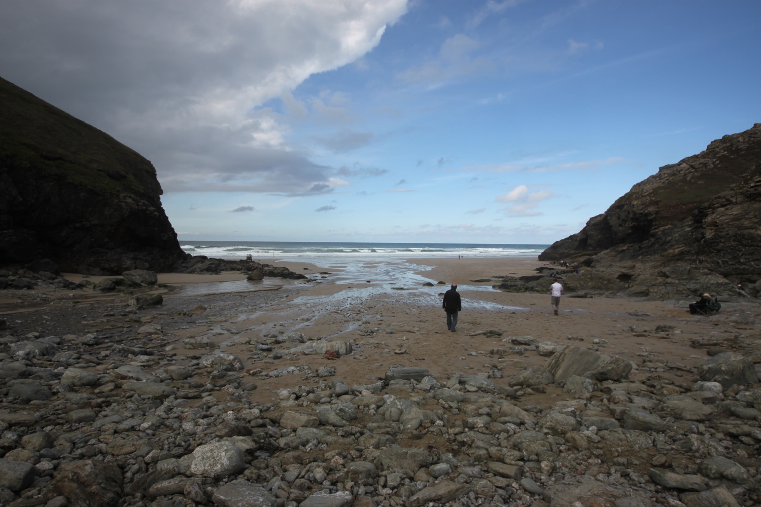
I start the day back at Holywell Bay beach where I enjoy the fine, golden sand. It's a much calmer scene today and I can actually stand upright on the beach. I head back into the dune system where a footbridge takes me over the river.
holywell
A sign warns me that adders may be basking on sunny days in the dunes but I don't see any.
A now overgrown big, red sign warns me about the dangers of entering Penhale Army Training Area. Odd because Penhale Camp was closed by the Ministry of Defence in April 2010 and partially sold off in September of the same year.
big red sign
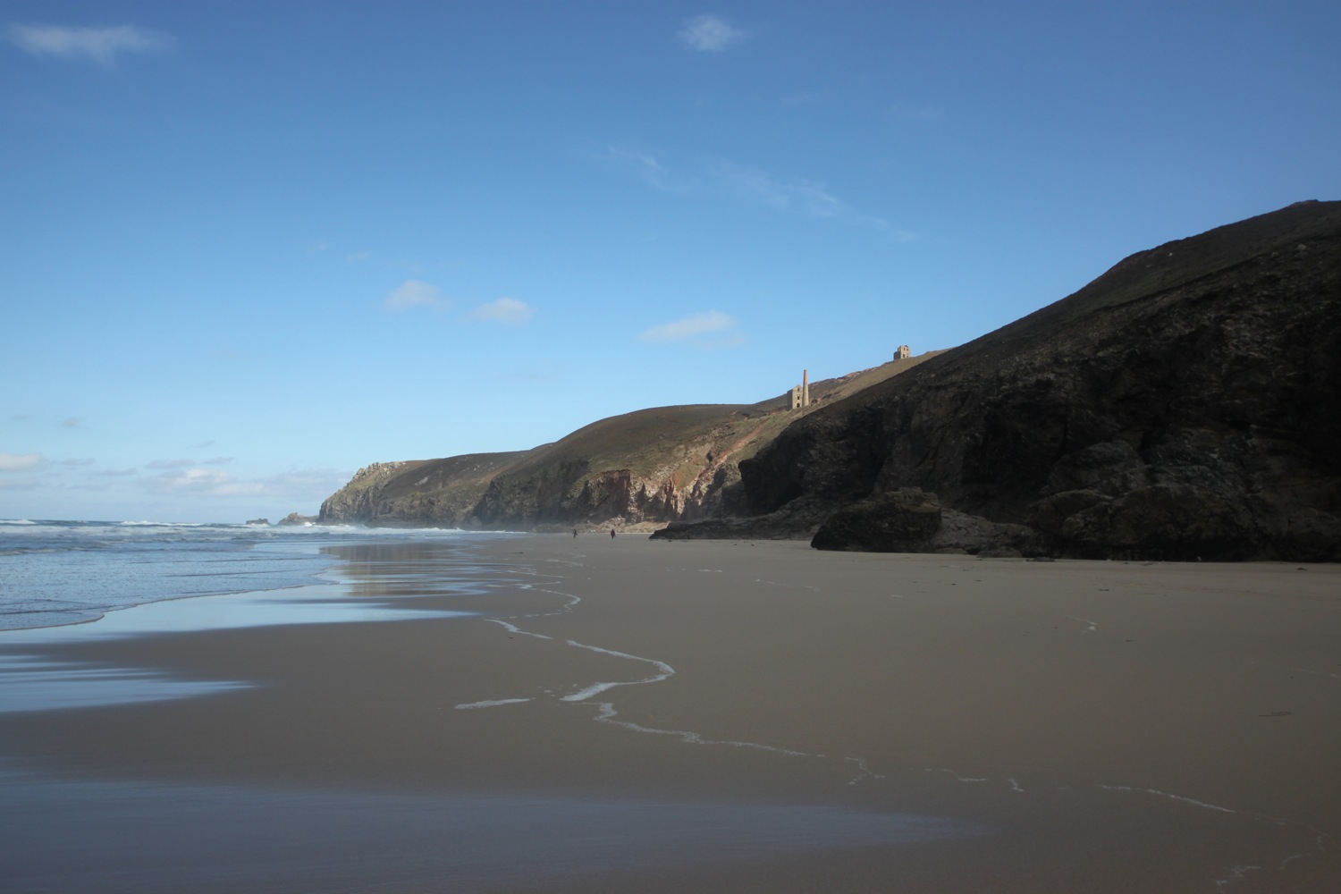
I round Penhale Point, taking one last glance back over Holywell.
overlooking holywell
I avoid the mine shafts and continue along the cliffs above Hobblyn's Cove.
danger mine shaft
Penhale Camp is now the home to the Penhale Military Adventure Training Centre and offers a broad range of military adventurous training.
a brooding penhale army training camp
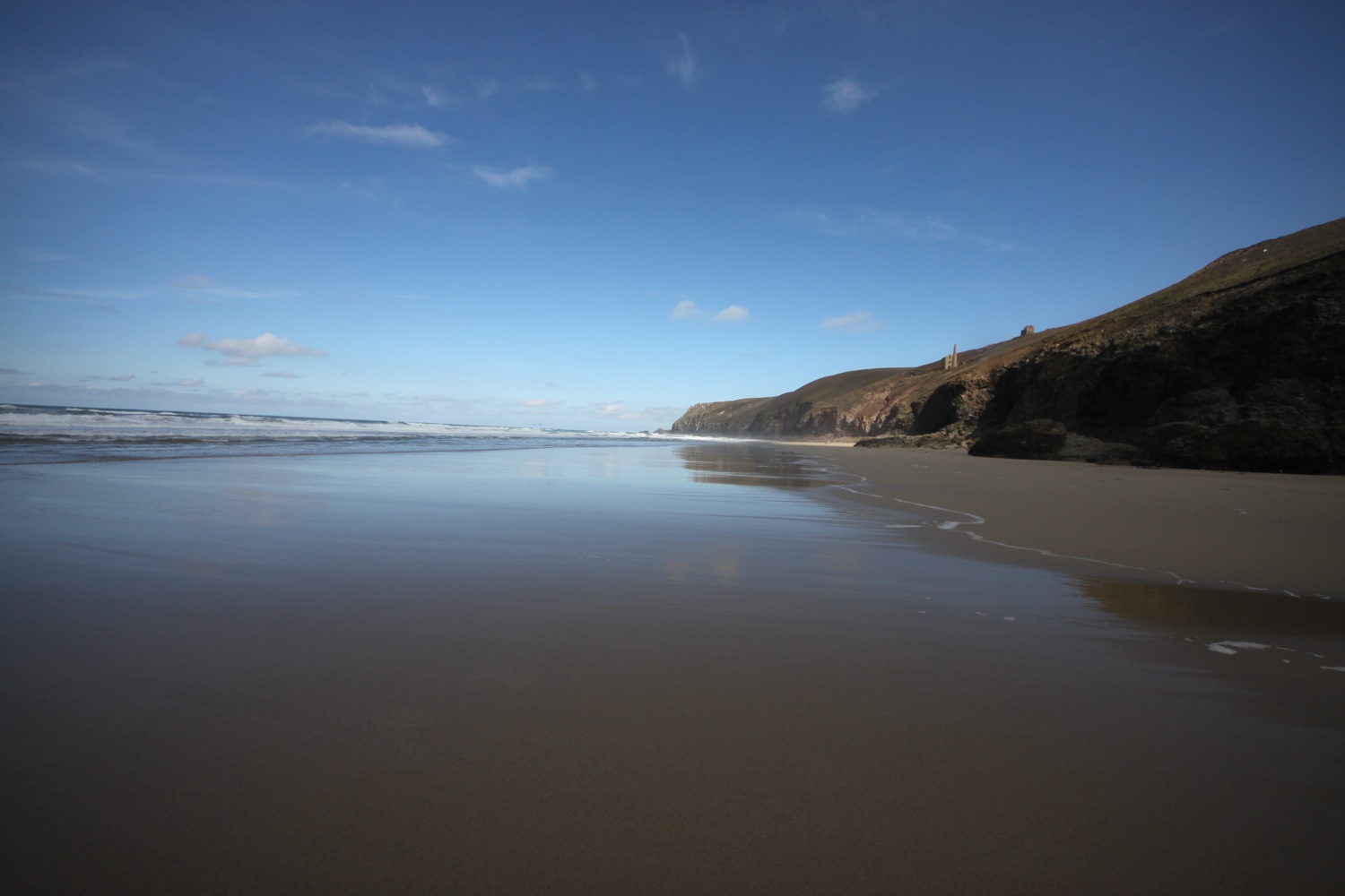
I round Ligger Point and have magnificent views along Perran Bay. I can see that the waves are crashing against the cliffs in the distance so I won't be able to make it all the way along the beach to Perranporth. I think I can make out an exit point about a mile down the beach so I should be able to make it onto the dune system.
overlooking penhale sands
I wander down the path to reach Perran Beach and I now hopefully have a one mile trudge along fine, golden sands before clambering back onto the sand dunes to reach Perranporth.
footsteps on perran beach
Behind the beach is Penhale Sands, the most extensive system of sand dunes in Cornwall.
About a mile down the beach I come to the exit point next to the lifeguard station and I clamber up the steep concrete path and then wander through the dune system to reach the beach at Perranporth.
perranporth beach
I wander along the beach front at Perranporth, passing the Black Flag Brewery (@blackflagbrews) and the Tywarnhayle Inn (@tywarnhayleinn) and climb up Cliff Road passing above the Seiners Arms (@SeinersArms) to leave Perranporth, where I have fine views back across the town and beach.
perranporth
overlooking perranporth
I pass a sundial thing pointing north and loads of flowers and memorials including this rather sad one …..
“An angel in the book of life
wrote down our baby’s birth
and whispered as she closed the book
too beautiful for earth”
I walk behind the rather ugly Droskyn Castle and pass the youth hostel on Droskyn Point. I pass a memorial bench and next to it is a pile of stones. I assume the two are related somehow.
karens bench
pile of stones
I'm now firmly in tin mining country and I walk through a scarred landscape of capped mine shafts, crumbling buildings and spoil heaps.
mining buildings
capped mine shaft
The gorse and heather is making the top of the cliffs very colourful.
gorse and heather
I head across Cligga Head and amble along the crumbling cliffs next to Perranporth Airfield, now home to Perranporth Flying Club but once a Second World War airfield. I don't see or hear any planes. The British and Colonial Explosive Works, opened in 1893, used to exist here but were largely destroyed by the construction of the airfield.
unstable cliff
view back over cligga head
I pass some concrete bunkers and I can now see the village of St Agnes climbing up the valley above Trevaunance Cove.
view over st agnes
I head down into the valley at Trevellas Combe, where there is a shingly and stony beach. The valley here was heavily mined and various remains of Blue Hills Mine, which closed in 1897, can be found here, including the crumbling engine house.
trevellas combe
I head inland next to the road and river to reach Blue Hills Tin Streams. The valley floor here once contained extensive tin stream works, used to recover any tin that could be gleaned from the river.
I cross a road bridge and then trudge up a steep track before descending to Trevaunance Cove, at the foot of the village of St Agnes.
trevaunance cove
trevaunance cove
Five attempts were made to construct an artificial harbour here to serve the mines in the surrounding area but all that remains are a pile of granite blocks at the bottom of the cliff, once part of the breakwater.
granite blocks at the bottom of the cliff
I wander back up to St Agnes heading slightly inland but not quite reaching the Driftwood Spars (@driftwoodspars). I follow the road out of Trevaunance Cove which leads me to Trevaunance Point where I have a lovely view back over the cove next to some dahlias.
dahlias overlooking trevaunance cove
I follow the path to St Agnes Head, on the way passing the remains of what was once Polberro Mine. I walk underneath the National Coastwatch station and then follow the cliffs in a southerly direction and have magnificent views back to Penhale Sands and forward over Chapel Porth and Porthtowan.
view back to penhale sands
view over chapel porth
I pass Tubby's Head, home to an Iron Age promontory fort before passing below the photogenic and much photographed (and that includes by me!) Towanroath pumping engine house at Wheal Coates, built in 1872 and now owned by the National Trust.
towanroath engine house
The coast path eventually leads me to Chapel Porth, home to the Chapel Porth Beach Cafe. I wander down to the beach and enjoy the sand before heading inland past the cafe and next to the stream.
Inland slightly can be found Wheal Charlotte, opened in 1806 but with a ropey mining history and now owned by the National Trust.
I cross the stream and then walk inland up a gentle path before swinging sharply back round again and climb uphill on to the cliffs where I come across more spoil heaps. I amble along the cliffs, admiring the views over Porthtowan.
porthtowan
I drop down to the village, walking past the Blue Bar beach cafe, and head out on to the large sandy beach. This is one of the best surfing beaches around and there's a bit of action out on the waves today.
Within the valley leading down to the sea at Porthtowan can be found Wheal Ellen with its distinctive castellated chimney stack, Tywarnhaile Mines and United Hills. In the heart of the village can be found Wheal Lushington, built in the 1880s, but the company building it went bankrupt before the engine could be installed and it is now a residential house.
wheal lushington
I head back up the beach and pass the Unicorn before following the road up to what was once the Beach Hotel but where apartments appear to have been built.
I continue along a track set back from the cliffs and pass Gullyn Rock and Sheep Rock, next to the fence surrounding what was once Portreath Airfield on Nancekuke Common. Warning signs keep telling me that I'm walking next to MOD property and should KEEP OUT. Quite why the MOD needs so much land sitting idly I do not know.
The walking towards Portreath is pretty uneventful except having to climb down and up steps at a couple of steep valleys.
steep valley towards portreath
I walk along Lighthouse Hill with views over the harbour and the beach at Portreath.
portreath
The road takes me down to The Square where I find the Portreath Arms and Portreath Bakery. From here it's a short walk past the harbour and The Waterfront Inn (@beachpub) and up to the car park above the beach.
That's my walking finished for the week.
FLORA AND FAUNA
Flora and fauna encountered on the walk today includes :-
- heather
- gorse
- bracken
- gulls
- hemp agrimony
- oystercatchers
- wrens
- robins
- red admiral
- hawthorn
- dahlias
- red and white valerian
- apples
- large flowered evening primroses
- hydrangeas
- crocosmia
- small tortoiseshell
- swallows
- goldfinches

PODCAST
The podcast of today's walk is now available. You can subscribe via the iTunes store or listen using the player below.

MARKS OUT OF TEN?
According to my phone I've walked 18.5 miles today which amounts to 41534 steps. After yesterday's terrible weather it has been lovely walking today and the views have been magnificent. Nine out of ten!
chapel porth
towanroath engine house


