bantham to salcombe

SOUTH WEST COAST PATH

saturday, 10TH MAY 2025

Start location: Bantham (SX 66847 43731)

End point: Salcombe (SX 73978 39343)

Map: Explorer OL20

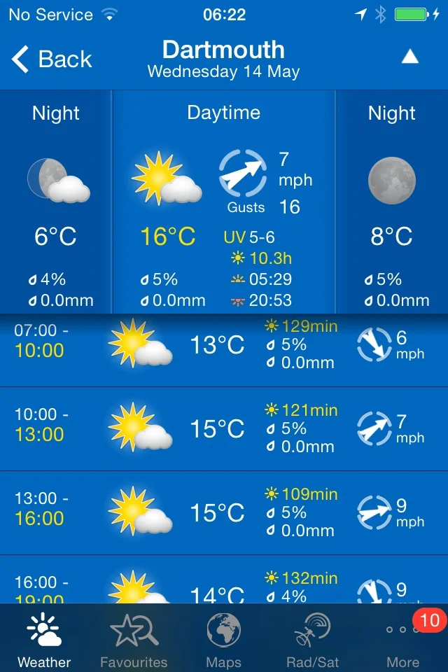
Although there is a bit of rain around this week it looks like I'm in for some beautiful weather today.

Dartmouth low tide 11:33

Dartmouth high tide 17:53

We drive from our holiday cottage, Higher Dinnicombe, over to Bantham where I’m dropped off at the road which leads into Bantham village, next to the Sloop Inn.

sloop inn

I head through the car park and explore sandy Bantham Beach where I share the beach with a family who are camping here. There are, however, a load of surfers and paddleboarders out in the sea. 

I head through sand dunes to rejoin the coast path proper where there are fine views back along the coast to Burgh Island but I head in the other direction along the edge of Thurlestone Golf Course

thurlestone one mile

I come across big black beetles on the golf course and stonechats are clacking all around me in the scrubby vegetation. I take in more of the wildflowers on the golf course and there are massive clumps of sea thrift and kidney vetch clinging to the low cliffs.

I wander across Thurlestone Beach and then Leas Foot Sand before reaching South Milton Sands. Thurlestone Rock can be seen out at sea.

On leaving South Milton Sands I head out onto the low cliffs past Beacon Point and Mouthwell Point on towards Outer Hope. It is now a straight drop into the village.

Easy walking takes me down to the Hope and Anchor Inn. I have lovely views over Hope Cove which consists of Outer Hope Beach and Inner Hope Beach. 

outer hope

outer hope

I follow the road and a path through the village to reach Inner Hope. I wander down onto the beach and explore for a bit before it's time to head for Salcombe.

I climb some steps out of Inner Hope and follow a woodland path out on to the open slopes leading to Bolt Tail where I enjoy the views across Hope Cove and the wildflowers.

bolt tail

I amble around Bolt Tail which was once an Iron Age promontory hill fort.

bolt tail iron age hillfort

I walk around the headland passing Yeovil Rock, Wolf Rock, China Rock and Graystone Ledge and then climb Bolberry Down at 395 feet. Skylarks are everywhere singing their hearts out but it is very blustery so recording them is difficult.

bolberry down

I come across a herd of long horn cattle who are as docile as anything.

long horn cattle

long horn cattle

The path continues before dropping steeply from Cathole Cliff into a valley where a footbridge crosses Soar Mill Cove.

I walk along The Warren where I enjoy the views back to Bolt Tail. 

I pause to admire the views here before continuing along the path, passing Little Mew Stone and Mew Stone. I enjoy all of the wildflowers next to the coast path.

As I round Bolt Head I now have lovely views across Starehole Bay but the coast path signs have dried up and I must have chosen the wrong path because none of this is familiar even though I haven’t been here in quite some time.

whoops! wrong way!!

I do have lovely views along the estuary over to Salcombe now.

view over salcombe

I keep going and eventually come across a sign that links me back to the coast path, next to Overbecks Garden. On the path back down to the coast path I pass a ginormous bee hotel and an equally ginormous echium.

bee hotel

echium

A proper road continues to the beach at South Sands where I pass the South Sands Hotel. I explore the beach here.

I continue on the road, first rising uphill and then down to North Sands Beach.

I pass the Winking Prawn Beach Cafe and then pass a small patch of cheery red hot pokers, before rising up and down again to reach Salcombe.

red hot poker

I have lovely views out to sea overlooking the estuary and also across the estuary over to East Portlemouth.

I amble along the road into Salcombe, admiring the MASSIVE echiums and the lovely views.

I walk around to the Ferry Inn where I will catch the ferry over from Salcombe to East Portlemouth tomorrow. I retrace my steps and head through the narrow streets and paths of Salcombe to the Creek Car Park where my lift awaits.

salcombe

salcombe

FLORA AND FAUNA

Flora and fauna encountered on the walk today includes :-

  • linnet

  • whitethroat

  • skylarks

  • oystercatchers

  • song thrush

  • chiff chaff

  • wild carrot

  • red campion

  • sea thrift

  • kidney vetch

  • gladioli

  • greater stitchwort

  • bluebells

  • gorse

  • foxgloves

  • long horn cattle

  • hawthorn

  • wild garlic

  • red hot pokers

PODCAST

The podcast of today's walk is now available. You can subscribe via Apple Podcasts or listen using the player below.

MARKS OUT OF TEN?

According to my phone I've walked 12.4 miles which amounts to 32957 steps. It has taken me 5 and a quarter hours. The weather has been beautiful and the walking has been lovely. Nine out of ten!

WALK DETAILS

MAP

sea thrift

long horn cattle

bee hotel

beach collection

the river erme to outer hope

south west coast path

14th may 2014

Today's weather forecast looks to be fantastic again, with sun forecast all day long and warm temperatures. Woop!

Dartmouth high tide 19:00

Dartmouth low tide 12:02

I resume my walking on a country lane about a mile away from the mouth of the River Erme, first thing in the morning. The plan for the day is to walk to Outer Hope which isn't very far on a map but I'll have to head a long way inland to skirt around the River Avon.

I enjoy the wildflowers romping away in the roadside verges and there are loads of butterflies flittering away even at this early hour. I even find a couple of obliging specimens to photograph.

speckled wood butterfly

bluebells

wall brown butterfly

cow parsley

I continue down the lane to reach Wonwell Beach and admire the fine views back across Erme Mouth. It's surprisingly busy at this time of the morning - well, there was a couple of dog walkers and three fellow coast path walkers. 

wonwell beach

I walk across Ferrycombe Beach and then I'm immediately greeted by skylark song before climbing onto Beacon Point at 330 feet and then Hoist Point. After that there is a steep drop down to Westcombe Beach. It's pretty remote here so I have the whole beach to myself.

ferrycombe beach

westcombe beach

I climb a steep set of steps and enjoy the fine views over the rugged South Devon coastline before reaching Ayrmer Cove. The beach is deserted so I spend some quality time wandering around, exploring the strandline.

south devon views

ayrmer cove

I climb onto Toby's Point before dropping down to Challaborough Bay. Here can be found the Challaborough Bay Holiday Park. It's busier on Challaborough Beach but you wouldn't guess it from the photograph.

challaborough beach

I amble across the beach admiring the views over to Burgh Island.

I climb off of the beach and head for Bigbury-on-Sea. The tide is out so I enjoy the fine sandy beach and take the opportunity to wander over to Burgh Island. The Pilchard Inn, dating back to 1336, can be found on the island but it's nowhere near opening time. The sea tractor, which carries passengers back and forth between the island and the mainline when the tide is in, is parked next to the island.

pilchard inn

sea tractor

burgh island

I head inland along the B3392 to reach a sign giving details of the ferry over the River Avon.

The ferry only seems to run between 10am and 11am so I've missed it by about three quarters of an hour. I head inland along the 9 mile diversion around the River Avon but almost immediately get lost as the signs make no sense. I abandon the diversion, summon up a lift and head back to Bigbury-on-Sea.

My lift arrives at the Bigbury-on-Sea car park and we drive around the River Avon to reach Bantham village,  passing the Sloop Inn. As I write this, the village of Bantham is due to be sold shortly for an estimated price of £10 million. Seems nice here so I check my pockets but all I've got is loose change.

 I explore sandy Bantham Beach before regaining the coast path proper where there are fine views back along the coast to Burgh Island but I head in the other direction along the edge of Thurlestone Golf Course

bantham beach

I wander across Thurlestone Beach and then South Milton Sands. Thurlestone Rock can be seen out at sea. South Milton Sands features in this short clip from The Storms that Shook the Southwest shown on BBC1.

The coast path is closed here so I divert along a road to Pitchingstone Cross and then along what is flattering described as an unmetalled road - it's a track! The diversion heads back towards the sea and then descends to Hope Cove and my destination for the day, Outer Hope, I get tantalisingly close to Outer Hope (10 metres!) before a bizarre diversion forces me uphill again and around Outer Hope before descending in to the village again.

Easy walking takes me down to the Hope and Anchor Inn. That's the end of the walking for this week. I'll be back on the South West Coast Path on the 7th of June (happy birthday to me!) when I'll probably walk from Penzance to Falmouth.

outer hope

FLORA AND FAUNA

Flora and fauna encountered on the walk today includes :-

  • wall brown butterflies
  • speckled wood butterflies
  • peacock butterflies
  • bluebells
  • red campion
  • wild garlic
  • cow parsley
  • skylarks
  • chaffinches
  • navelwort

PODCAST

The podcast of today's walk is now available.  You can subscribe via the iTunes store or listen using the player below.

MARKS OUT OF TEN?

According to my phone I've walked 15 miles today which amounts to 32274 steps. I've had gorgeous sunny weather all day long, it's been a beautiful spring day and the walking has been fantastic. 9 out of 10.


View the river erme to outer hope in a larger map

the river erme